- News
- Reviews
- Bikes
- Accessories
- Accessories - misc
- Computer mounts
- Bags
- Bar ends
- Bike bags & cases
- Bottle cages
- Bottles
- Cameras
- Car racks
- Child seats
- Computers
- Glasses
- GPS units
- Helmets
- Lights - front
- Lights - rear
- Lights - sets
- Locks
- Mirrors
- Mudguards
- Racks
- Pumps & CO2 inflators
- Puncture kits
- Reflectives
- Smart watches
- Stands and racks
- Trailers
- Clothing
- Components
- Bar tape & grips
- Bottom brackets
- Brake & gear cables
- Brake & STI levers
- Brake pads & spares
- Brakes
- Cassettes & freewheels
- Chains
- Chainsets & chainrings
- Derailleurs - front
- Derailleurs - rear
- Forks
- Gear levers & shifters
- Groupsets
- Handlebars & extensions
- Headsets
- Hubs
- Inner tubes
- Pedals
- Quick releases & skewers
- Saddles
- Seatposts
- Stems
- Wheels
- Tyres
- Health, fitness and nutrition
- Tools and workshop
- Miscellaneous
- Tubeless valves
- Buyers Guides
- Features
- Forum
- Recommends
- Podcast
TECH NEWS
 2022 Komoot Trail View - 1 (4)
komoot launches Trail View for improved route planning
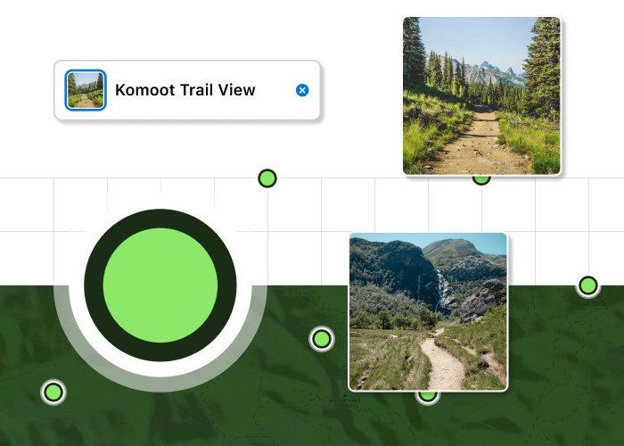
The route planning and navigation digital platform komoot has launched a new feature called Trail View that adds user-contributed photographs of paths and trails to maps so you can, for example, check whether a route is suitable for riding on a gravel bike and/or with your level of experience before setting out.
“An image recognition technology that uses artificial intelligence to curate images, Trail View has been born out of komoot’s desire to provide its community with the most information-rich portrayal of the trail ahead - through images,” says komoot.
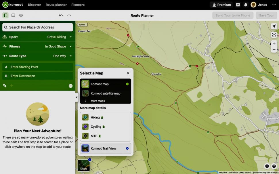
Trail View is available to all users via the komoot web platform. You just select the Trail View map layer.
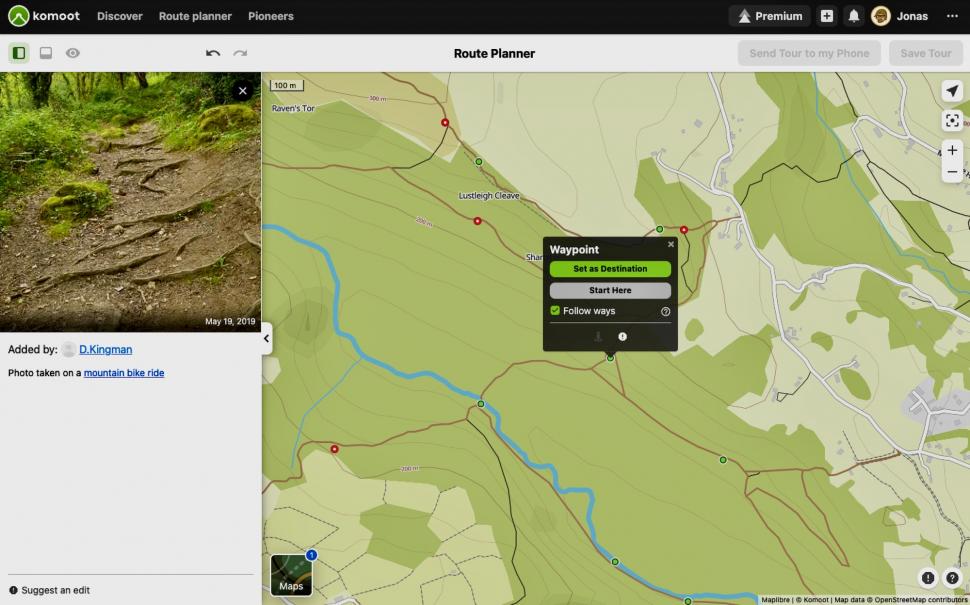
Photos contributed by komoot users who have been on that trail already show up as green dots on the Trail View map. You click the dot to view the image. But Trail View doesn’t include all user images.
Find out how to get started with komoot
“Trail View scans all uploaded images and shows only those with paths and trails,” says komoot. “It eliminates images that do not fit the criteria (images that include faces, animals, landscapes, buildings etc).
“To launch Trail View, over 15 million images uploaded to komoot by its community have been automatically scanned to identify approximately one million that show trails and paths. And it will only get better as the community contributes more informative images of trails to help others to visualise their adventure before setting out.”
We all know that what’s shown as a track or trail on a map can vary enormously. It might be well-surfaced or it might be a boggy mess. Say that you’re planning a gravel bike ride with friends who lack experience on anything but asphalt. You can use Trail View to check out whether the route you have in mind is going to be suitable for you all and the bikes you’re riding.
Also, Trail View can help you if you’re looking for a more technically challenging route.
Check out road.cc's favourite rides on komoot
“Clear information about the condition and composition of the trail will help mountain bikers choose the right equipment, hiking families and groups to reduce risk, gravel cyclists to avoid paths with rocks – increasing the likelihood of Type 1 fun all-round,” says komoot.
“It also provides a reason to get excited as komoot users can now visualise what awaits them on their adventures.”
Trail View is available now to all komoot users.
Mat has been in cycling media since 1996, on titles including BikeRadar, Total Bike, Total Mountain Bike, What Mountain Bike and Mountain Biking UK, and he has been editor of 220 Triathlon and Cycling Plus. Mat has been road.cc technical editor for over a decade, testing bikes, fettling the latest kit, and trying out the most up-to-the-minute clothing. He has won his category in Ironman UK 70.3 and finished on the podium in both marathons he has run. Mat is a Cambridge graduate who did a post-grad in magazine journalism, and he is a winner of the Cycling Media Award for Specialist Online Writer. Now over 50, he's riding road and gravel bikes most days for fun and fitness rather than training for competitions.
Latest Comments
- perce 3 hours 2 min ago
Oh god is he still here? Still not found a publisher for his stories?
- chrisonabike 4 hours 34 min ago
You've been quoted in the article as being concerned "about the safety of cyclist and vehicles”....
- S.E. 9 hours 16 min ago
My guess is that they sell mainly on the German market - feel free to correct me. That might explain why they are not "pushing" their products,...
- ktache 9 hours 41 min ago
Now Emily Chappell really liked the Lezyne , I have the HV version, good, but I find the handle uncomfortable in use. I've often wondered about the...
- biking59boomer 8 hours 48 min ago
What about this one!? Taken in Cardiff Civic Centre 1939
- Muddy Ford 9 hours 51 min ago
Charlie Alliston got 18mths and is the reference case (because there are so few cases) for all campaigns by anti-cyclists that 'cyclists are not...
- belugabob 10 hours 53 min ago
My local football practice pitches (all weather, in a fenced off area, are regularly the scene of inconsiderate parking, with vehicles blocking the...
- Spangly Shiny 11 hours 18 min ago
Assos ASOS anyone?
- chrisonabike 11 hours 31 min ago
Replace them all with Bromptons and they'd take up zero space within days or even hours, as they are all relocated elsewhere. To eBay or possibly...
- Andrewbanshee 12 hours 2 min ago
Where I live we are experiencing a lot of housing development on small and large plots of land. These developers don't seem to have problems...


Add new comment
4 comments
I always use Komoot and then sync the route with a Wahoo (can even do it mid-ride if necessary); some features have gone subscription only so may have to start paying in the future. Open Cycle Map shows national cycle routes in european countries. This would be a good feature to check out a un-tarmaced path (as some bike paths are) to see if it's road bike friendly, or even to see whether single-track is gravel or MTB.
Never had any success planning rides with Komoot...the only time I got it to work was to uploaded a pre planned route with Plotaroute...so I don't use it , tried it but a Plotaroute download in the format which works for mine and anyone's GPS unit with a Google earth fly through works for me.... Never failed yet. I pay for the premium version with O.S overlay....
By contrast, I've never had a problem with Komoot. Generally I just drag/drop waypoint markers and let komoot join the dots. Sometimes I plug in a destination and let komoot sort the whole route. Works on my phone or PC.
Nice idea. I just took a look and there are plenty of photos already there. Seems like you can only get a small hover-over pic though, not a full size image? Maybe that's enough for the intended purpose.
I've been experimenting with using a 360 cam to contribute blue lines to Google Streetview with the aim of adding GSV to some local unsurfaced trails. Here's an example: https://goo.gl/maps/mCCku1VScUx4QEdf7
I can't deliver anything near the same quality as proper Google GSV however.