

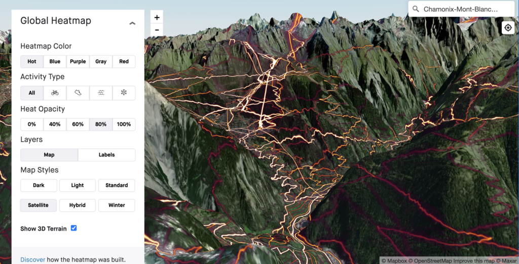
Strava has added its 3D Terrain View to its Global Heatmap for easier planning and previewing rides with a “realistic and high-definition view”.
The fitness tracking and activity recording app already has its Global Heatmap which is visible over here or when you are in the route building mode, and this latest extension brings these heatmap lines into 3D.
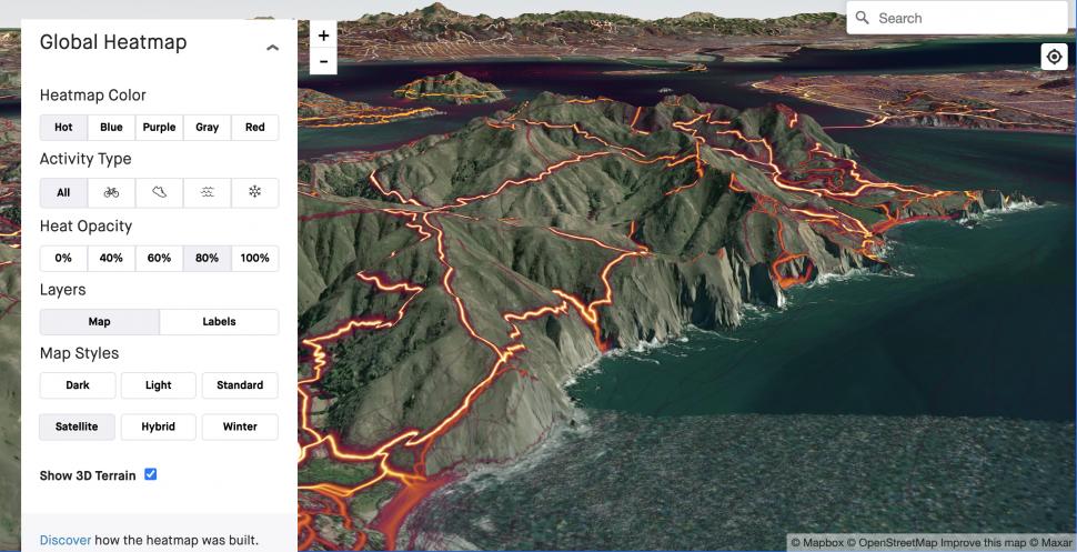
The Global Heatmap shows the “heat” made by the app’s users over the last year to reveal the most popular segments of roads to help you plan your next route or adventure.
“Athletes who frequently cover mountainous or varied terrain will find it useful to see where the community explores most frequently to inspire their rides,” says Strava.
> 8 things you didn’t know about Strava — advanced features for exploring and performance analysis
This follows on from Strava’s 3D terrain view update for Personal Heatmaps earlier in the year to better depict the terrain covered and the latest extension will enable users to make use of the 3D view when planning out their next challenge.
Strava explains that subscribers will be able to toggle between their Personal Heatmap in 3D and the Global Heatmap.
The biggest app update of the year so far is still when Strava added new personalised recommendations on the updated Maps tab for easier segment hunting to achieve PRs and discover new routes, as well as new Group Challenges for competition amongst friends. Find out more about this in the full story here.
Strava also added location details in users’ activity feeds earlier in the year.


