

Plans to put the Peak District at the heart of a national cycling network have been given the go-ahead by the Peak District National Park Authority. The strategy will see expansion of the area’s network of trails and signposted routes as well as an improvement in cycling specific facilities
The Matlock Mercury reports that members of the Peak District National Park Authority last week agreed to go ahead with the Wider Peak District Cycle Strategy. A document outlining the plans reads:
“This strategy isn’t just about cycling the Peak District’s network of trails, it’s about putting the Peak District at the heart of a national cycling network. It’s about connecting inspirational landscapes with major cities and enabling the Peak District to be a destination for cycling trips – significantly contributing to the visitor economy.”
The strategy divides the plans into four themes. Theme one is to increase the network of routes; theme two is to support cyclist infrastructure so as to provide a welcome to cyclists and to stimulate the cycling economy; theme three is to promote the Peak District cycling experience; and theme four is to develop sustainable transport packages.
Plans are divided into short, medium and long-term plans with the short term covering from now until 2016.
In terms of the network itself, there are already a number of green lanes, bridleways and multi user trails in place. However, gaps have been identified with different paths and trails not necessarily connected. There are very few signed, circular routes and it is also felt that businesses aren’t always aware of the needs of cyclists.
The aim is to create new traffic-free routes and add signs to join sections of the existing network and other places of interest. Iconic multi-day loops will also be created and there is also a view to develop a more connected, comprehensive and progressive mountain biking offering.
Funding has already been confirmed for a number of new routes and route extensions.
The Staffordshire Moorlands Link is a 23km stretch from Stoke-on-Trent to the Roaches and Waterhouses. It is off road between Stoke and Leek along a canal towpath and on road with signage for the remainder.
The Little Don Link is 19km and primarily off-road. It will link Winscar Reservoir with the Transpennine Trail and on from there to Beeley Wood in Sheffield.
The 8km Hope Valley Link runs between Hathersage and Castleton, linking to the Little John Route between Sheffield and Manchester which is signed by Sustrans.
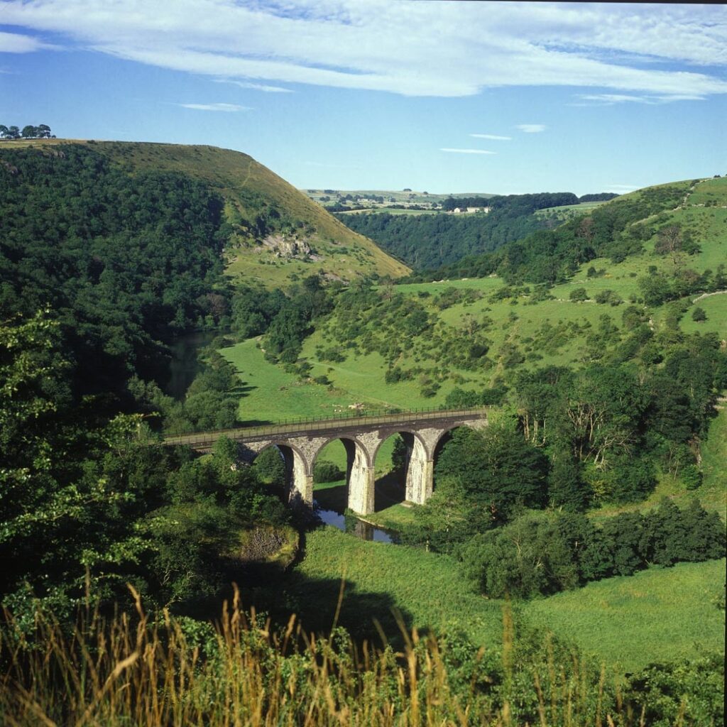
The White Peak Loop is to be extended by 18km with the northern end of the High Peak Trail going on to Buxton and the southern end of the Monsal Trail going on to Matlock. The ultimate aim is to create a 60-mile circuit connecting the existing High Peak, Tissington and Monsal Trails into Buxton, Bakewell and Matlock.
There is also an intention to create cycle-friendly destinations. Focused on market towns, the aim is to provide secure or better cycle parking, traffic calming measures and clear route information so that these towns can serve as gateways to the Peak District for cyclists.
Earlier in the year, we reported that £10,000 of grants are being made available to Peak District businesses and other local organisations for the improvement of facilities for cyclists. It is hoped that this combined with the development of attractions along cycle routes and the provision of a web-based sustainable transport information service will also contribute towards making the Peak District a diverse, accessible cycling destination.


16 thoughts on “Expanded cycling network and improved facilities as Peak District looks to promote itself as top cycling destination”
we spent a week near Matlock
we spent a week near Matlock over summer, I was kicking myself that I didnt have a bike with me, some great riding to be had around there.
Same here, though my wife
Same here, though my wife wouldn’t have let me even if I wanted to. It is great cycling area, some beautiful scenery, friendly folk, plenty of small quiet side roads and some killer hills. I found a 20% one that looked like torture….plan to go back with the boys for a fun weekend. Unlike the new forest, the local authorities in Matlock can see the money this brings in to the local economy, good on them. This part of the world produces some of our best cyclists, hard as nails.
Wouldn’t it have been nice if
Wouldn’t it have been nice if the cycling money the New Forest fraudulently acquired had ended up actually being used for cycling somewhere like the Peak District?
Blimey, this looks good. I
Blimey, this looks good. I ride in the area anyway, but once we hopefully complete our house move from Manchester to Congleton, this might be even more accessible. I guess the business case looked at the boost Yorkshire got from the TdF and is trying to exploit that market sans the big race.
Get off my roads!
Seriously
Get off my roads!
Seriously this is great news – the cycling round here is fantastic, but hopefully the extension of the Monsal & High Peak Trails into town centres will encourage more people to use their bikes as transport as well as all the leisure cyclists in the area at weekends.
To be fair the drivers are generally very good around cyclists – on my daily commute from Wirksworth to Matlock pretty much everything including busses, taxis & HGVs wait and pass me sensibly, probably because there are a fair few riders on the road so they an accepted part of the traffic here. Having said that some wannabe Daily Mail columnist had a rant about cyclists intimidating and slowing her down on a Sunday drive by cycling in groups in the Derby Telegraph earlier this week with all the predictable road tax comments from Clarkson’s fan club.
The Tissington, High Peak and
The Tissington, High Peak and Monsal Trails are lovely, but like so many similar rides they are basically Sustrans making the best of leftover scraps of closed-down railway which nobody else wants.
As the article suggests, this means they are piecemeal, relatively short, not circular and not linking conveniently with towns and public transport hubs; by their very nature they are in locations which no longer have stations 🙁 .
Despite this these trails can be overwhelmed by families who want a safe bike ride on a sunny day. They drive there, ride out and back, and drive home again. There really is an appetite for these kind of good quality traffic free routes. But even the trans-pennine-trail is a slightly odd mixture of bumpy off-road and some unpleasantly busy A-road. So if the NPA are serious, and I hope they are, they will need to spend some serious money on proper infrastructure dedicated to cycling.
“The ultimate aim is to
“The ultimate aim is to create a 60-mile circuit connecting the existing High Peak, Tissington and Monsal Trails into Buxton, Bakewell and Matlock.”
That’s really something to look forward to.
Just to correct
Just to correct northernrebel: The High Peak and Tissington trails pre-date Sustrans by a long chalk (1971 according to Wikipedia – I first used them in about 1981) they are now part of longer-distance routes, the Derbyshire section of the Pennine Cycleway starts in Derby and is 80 miles long and the route ultimately ends in Berwick-on-Tweed, a little more than a day’s ride for most of us. Hardly the case that “nobody else wants” these trails either – the demand for their use as walking, cycling and horse-riding routes is immense.
The plans connect the trails with existing railheads at Matlock and Buxton as well as improving the links along the Hope Valley.
wildnorthlands wrote:Just to
Hi wildnorthlands, I think it was actually me you have corrected, and I’m grateful to be put straight.
To be pedantic regarding your first point, I didn’t say Sustrans created them, but as far as I’m aware Sustrans are now responsible for them.
Of course I realise that the trails are popular for more than just cycling, but my point stands that they only exist (like so many dedicated cycleways) because they were created as railway lines which were subsequently closed.
As for the Pennine Cycleway, I will look into it in more detail, but a cursory glance at the Wikipedia article tells me that “About 20% is on traffic-free cycleway routes”, which I imagine is fine for many of the readers on a site like this but I won’t be taking the kids along the other 80% any time soon and I’m sure a lot of people feel the same way. Drawing a line along a road on a map doesn’t make it a cycleway. It would be interesting to assess the whole route using the audit tools discussed in the latest CEoGB blog post – “the Welsh Guidance suggests that any route that scores below a threshold of 35 is not fit for inclusion in a cycle network, or to even be labelled as a cycle route“. If we consider these routes to be primarily for leisure rides (rather than useful for utility cycling) we might forgive a lack of directness, but I would expect them to be even more subjectively safe and “pleasant” than facilities aimed at commuters etc.
Also, I often find getting accessible online maps for these routes is a PITA. Usually a mixture of leaflet PDFs (with oversimplified maps) and text based descriptions. The sustrans online map is better, but I would much prefer to see a simple google map for each trail (like this), so I can get a feel for the location, and use streetview etc. Or just a gpx file would be a start, so I could make my own maps.
The Peak District is a
The Peak District is a fantastic location for cycling. I highly recommend anyone who hasn’t been to pay a visit with a bike, you won’t be disappointed and I’m sure that you’ll be back for more. I am puzzled that the plans laid out in the article describe largely off road facilities when the recent boom in cycling is very much road orientated. I think that a simple and relatively inexpensive way to attract visitors would be to put together a number of permanent well signed road routes. The routes could be colour coded ski run style ranging from quiet little pootles in Goyt Valley or around Ladybower and Derwent right through to 100 mile days out taking the famous challenges like Holme Moss and Winnats Pass, highlighting some good cycle friendly cafes along the way. I don’t think that everyone relishes riding off road on shared use paths. I do believe that Sustrans is well intentioned but they are a bunch of hippies on mountain bikes and seem to have a disproportionate say in the allocation of funds for cycling facilities which results in others following their lead. In my opinion, some proper consultation with cycling clubs or even British Cycling would go a long way.
@bedfordshire clanger – if
@bedfordshire clanger – if the plans favour off road, traffic free routes it’s because that’s what the majority of people want : folk on holiday, families, non ‘serious’ cyclists etc. You can be sniffy about sustrans but for all their faults they are trying to make cycling accessible to more than just a bunch of roadies – and that means taking car traffic out of the equation.
This is great news, I cycle
This is great news, I cycle in the Peak District almost every week, it’s a stunning and challenging area.
I recommend it to everyone.
New Forrest Council…….watch and learn. Oh, and give back the fraudulently obtained cycle cash.
This is great news, I cycle
This is great news, I cycle in the Peak District almost every week, it’s a stunning and challenging area.
I recommend it to everyone.
New Forrest Council…….watch and learn. Oh, and give back the fraudulently obtained cycle cash.
I do like Bedfordshire
I do like Bedfordshire clangers idea of ski-run-type coloured routes, although I can just imagine some tabloid nonsense about the “officially-endorsed racetracks”.
Most if not all of this was
Most if not all of this was originally announced in August 2013 as Pedal Peak Phase 2
http://www.derbyshire.gov.uk/leisure/countryside/access/cycling/pedal_peak/default.asp
hope it actually moves ahead soon before the funding expires
it is good to see a focus on enabling access out to The Peak that isn’t reliant on driving to cycle “honeypots”
waiting to see if Sheffield Council https://www.sheffield.gov.uk/roads/works/schemes/cycle-schemes.html
actually get it together on their section:
– “A link between Beeley Wood and Wharncliffe Woods at Oughtibridge. We are currently looking at a number of options to achieve this” and have been for several years with funding being a problem – pretty sure local Sustrans people have proposed a number of detailed schemes to by pass the horrible narrow/steep rail bridge on Station Lane, Oughtibridge which was actually used on the TDF route but is considered unacceptably dangerous by families – hope to get a proper TDF legacy out of this
Progress but unbelievably slow even with funding in place
I saw the surface made from
I saw the surface made from reclaimed tyres demonstrated at a TransPennine Trail meeting , and rode it at Penistone, it has to be better than crushed stone?
Surfacing should be usable by all and not just mountainbikes for new schemes?
Some of these routes parallel major roads and so would be an alternative for commuting and road riding