- News
- Reviews
- Bikes
- Accessories
- Accessories - misc
- Computer mounts
- Bags
- Bar ends
- Bike bags & cases
- Bottle cages
- Bottles
- Cameras
- Car racks
- Child seats
- Computers
- Glasses
- GPS units
- Helmets
- Lights - front
- Lights - rear
- Lights - sets
- Locks
- Mirrors
- Mudguards
- Racks
- Pumps & CO2 inflators
- Puncture kits
- Reflectives
- Smart watches
- Stands and racks
- Trailers
- Clothing
- Components
- Bar tape & grips
- Bottom brackets
- Brake & gear cables
- Brake & STI levers
- Brake pads & spares
- Brakes
- Cassettes & freewheels
- Chains
- Chainsets & chainrings
- Derailleurs - front
- Derailleurs - rear
- Forks
- Gear levers & shifters
- Groupsets
- Handlebars & extensions
- Headsets
- Hubs
- Inner tubes
- Pedals
- Quick releases & skewers
- Saddles
- Seatposts
- Stems
- Wheels
- Tyres
- Health, fitness and nutrition
- Tools and workshop
- Miscellaneous
- Cross country mountain bikes
- Tubeless valves
- Buyers Guides
- Features
- Forum
- Recommends
- Podcast
feature
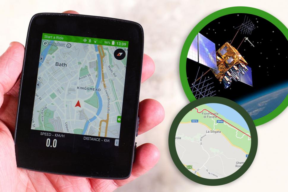 GPS bike computers - find out 9 hidden hassles nobody mentions Nov 2020
GPS bike computers: find out 9 hidden hassles nobody mentions
GPS bike computers have revolutionised the way many of us navigate and record our rides but they have their downsides and pitfalls. Here are some of the issues we've experienced and heard about.
How do GPS bike computers work?
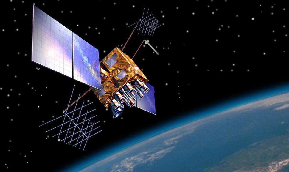
GPS bike computers use the Global Positioning System, a satellite-based navigation network owned by the US government. It provides geolocation to a GPS receiver, such as a GPS bike computer, anywhere on the planet.
GPS satellites orbiting the Earth transmit information about their position at regular intervals. GPS initially used 24 satellites but now there are 31 in orbit. Your GPS computer receives signals from multiple satellites and uses the information to calculate your position. As your position changes over time, your GPS bike computer can calculate your speed and record your routes.
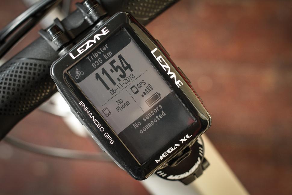
Although we talk about GPS, devices from brands like Garmin and Lezyne take signals from GLONASS satellites too, GLONASS being the Russian equivalent. Some devices now also use the EU's Galileo system which went live in 2016. We should really talk about global navigation satellite system (GNSS) devices, but GPS was the first so it has become the generic term.
Manufacturers of GPS navigation devices say that adding GLONASS to the mix allows positions to be fixed faster and more accurately. This is particularly important in built-up areas where the direct line of sight to GPS satellites could be obscured. If you have the choice, using GPS alone improves battery life but it might affect your computer's performance.
From a cycling point of view, GPS allows a bike computer to measure your speed without the need to attach a magnet to a spoke and a sensor to a fork leg. It can also record the routes you've ridden which can then be uploaded to a laptop/desktop computer later on.
Pay more money and you can get a GPS bike computer that allows you to plan and follow routes with onscreen mapping and turn-by-turn instructions, and you can chase KOMs on Strava and see your results in real time.
It's clever stuff. We're big fans of GPS bike computers here at road.cc, but they're not perfect...
Check out 15 of the best cycling GPS computers
Lost connections
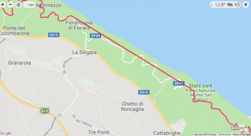
While GPS computers usually record your activities pretty accurately, they can occasionally get it wrong and this is sometimes caused by a lost satellite connection. If this happens, your recorded track will show a straight line between two points rather than tracing the route you really followed, and the distance you've ridden (and any data resulting from that, such as average speed) will be given incorrectly.
Environmental factors can interrupt the GPS signal between satellites and your computer. Although it's not as common as it once was, a lost connection can occasionally happen because of thick tree cover or steep terrain (when you're riding in a gorge or a mountainous area, for example), or when you're riding under a bridge or through a tunnel.
In order to reduce the chances of interrupted communication, make sure there are no obstructions above or around your GPS computer.
Incorrect trackpoints
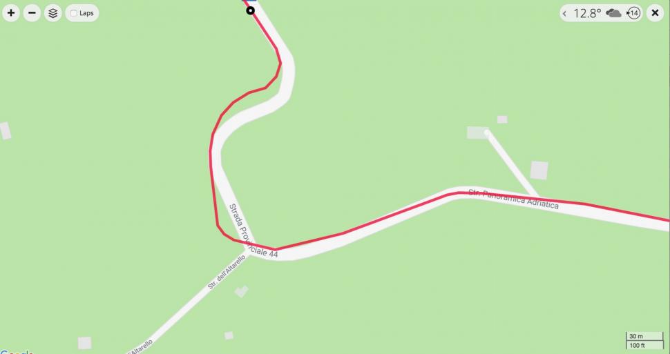
Another reason for bad data is that your GPS computer has recorded incorrect trackpoints – so you get a track recording that deviates from the road or trail you've really taken.
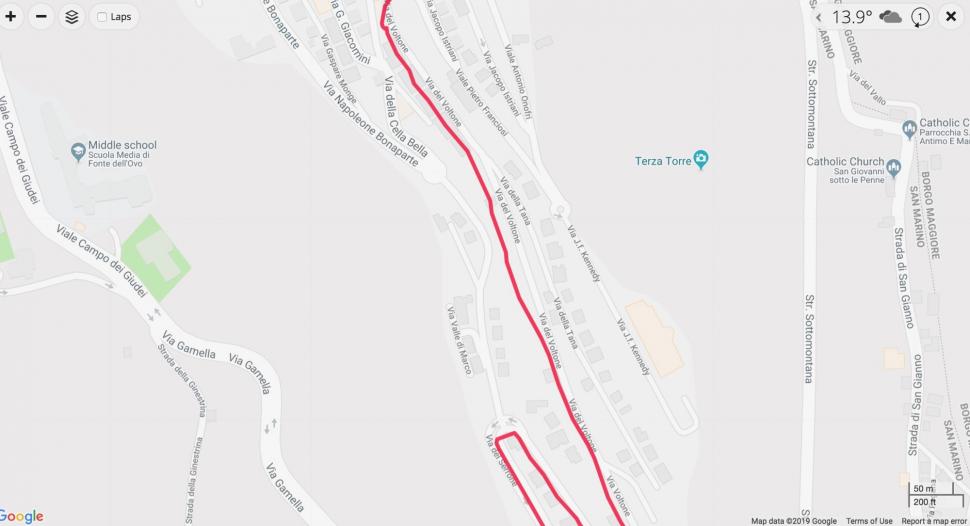
Tall buildings, for example, can sometimes cause weak signals to be reflected. Look back at a map of the route you've ridden and it might tell you that you spent some time riding through buildings rather than along the road. This can also affect the distance that the computer says that you have ridden and your average speed.
In some cases GPS devices are working properly but the mapping software is faulty, giving you the impression that you're riding through a field or wood when you're actually on the road.
Find out about 13 of the best cheap GPS cycling computers
Not everything is recorded
A GPS device doesn't record absolutely every movement you make. For example, with many Garmin fitness devices you can switch between Every Second Recording and Smart Recording.
What's the difference? If you are using Every Second Recording, as the name suggests, the device will take GPS information (along with any other data on your activity, such as heart rate) every second, no matter what.
"This recording type provides a more defined track log of an activity," says Garmin. "However, overall device memory will be filled up faster using this setting."
Smart recording, on the other hand, is designed to take up less memory.
"Smart Recording records key points where the fitness device changes direction, speed, heart rate or elevation," says Garmin. "This recording type allows the user extended recording time given that it is recording less track points.
"Smart Recording does not affect the performance of an activity as it pertains to the data being recorded such as pace and distance or heart rate. Smart Recording only affects the data that is written to the file for storage on the device and on Garmin Connect by removing data points that are essentially redundant."
The fact that a GPS device measures your location at intervals is responsible for the series of straight lines you can sometimes see on a bend once you've uploaded a route you've ridden. The GPS device joins a series of dots with straight lines rather than recognising your beautifully smooth cornering technique!
Read our complete guide to Garmin Edge GPS bike computers
GPS accuracy
The US government is committed to providing GPS to certain levels of accuracy (the commitments apply to the signals transmitted from satellites rather than to the accuracy of GPS devices like your bike computer, of course).
It commits to broadcasting the GPS signal in space with a global average user range error of less than or equal to 7.8 metres with 95% probability. Actual performance exceeds that specification, and your GPS device might be getting signals from GLONASS satellites too.
As well as the user range error, the readings you receive on your GPS bike computer will depend on satellite geometry and things like signal blockage (see above) atmospheric conditions, and the design features and quality of your computer (both the hardware and the software). There will always be a margin of error in the accuracy of any device's recording.
Incidentally, during the 1990s GPS accuracy was intentionally degraded for civilian (as opposed to military) use across the world, but this was ended in 2000.
Check out GPS cycle route planning made easy
You might get some questionable altitude readings
You might think that if your device knows whereabouts you are in the world it should be able to give your elevation based on that, but GPS isn't that good for calculating altitude, especially if reception is poor. That's why GPS bike computers have an in-built barometric altimeter. This uses changes in air pressure to calculate changes in altitude. The issue here is that temperature and weather can also change air pressure, affecting the readings.
Apps like Strava have elevation correction features. However, if your device has a barometric altimeter Strava won't make this elevation correction because, as long as it has been calibrated correctly, the data collected in that way will probably be more accurate.
Go to our GPS reviews to find out what you should buy
Small errors add up
Errors caused by the factors mentioned above can add up so you might find that if you go for a ride with friends you all get marginally different recorded data from the various bike computers and smartphones used. You could find that the distance, average speed and total elevation gain measurements given by your computer are different from those of somebody else's when in reality you've done exactly the same ride.
You might also ride exactly the same route on different days and get different distance and elevation data. GPS discrepancies are likely to be small in most cases but they're certainly possible.
Check out the GPS computers that the pros are using
Battery life
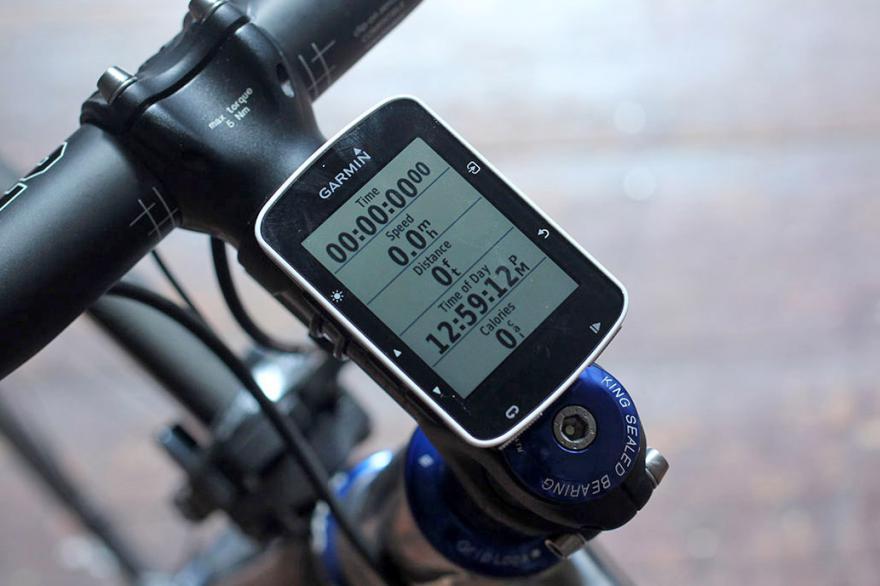
GPS measurement consumes a lot of battery power and following a GPS route on screen takes even more. Bear in mind that the GPS computer's runtime published by a manufacturer will usually be the best case scenario. Garmin, for example, gives a runtime of up to 15 hours for the Edge 520 and up to 20 hours for the Edge 1030, but in typical circumstances they're likely to need recharging sooner than that.
The runtime of any GPS computer will see you through the vast majority of rides you're likely to do, but you might need to equip yourself with an extra battery pack for something like an ultra-long Audax ride or multi-day touring.
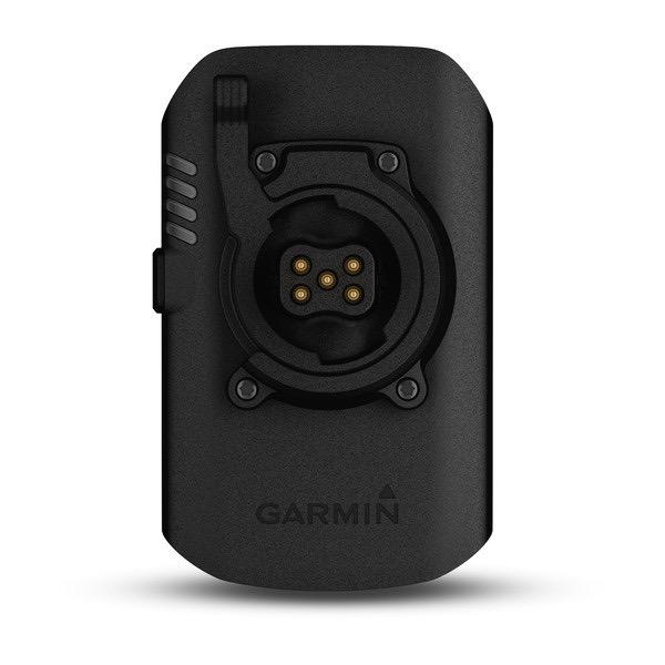
Garmin has a Charge Power Pack, for instance, that plugs directly into an Edge 1030 to provide up to 24 hours of additional battery life. You can use it on other compatible devices via a cable.
Read our review of the APC Power Pack
They can sometimes freeze/crash
GPS devices can sometimes do weird, infuriating things. Internet forums are full of people saying that their bike computer froze or crashed for no good reason. Some are more prone to it than others so do some research before deciding what you want to buy.
A non-functioning GPS is always annoying and sometimes a real problem. A computer that fails suddenly when you're relying on it for navigation could see you in the middle of nowhere without knowing which way to turn.
They might send you down unsuitable roads
If you can plan routes on your GPS computer you'll be able to tell it whether you want to stick to paved roads or whether you want to ride trails too... but this doesn't always work.
Garmin Cycle Map, for instance, is built on OpenStreetMap (OSM) information. OSM is a collaborative project to create a free editable map of the world – the mapping equivalent of Wikipedia. If an unpaved road is incorrectly labelled as a paved road on there, the routing software will take its word for it, so you could find yourself on a rocky bridleway when you were hoping for smooth tarmac.
Mat has been in cycling media since 1996, on titles including BikeRadar, Total Bike, Total Mountain Bike, What Mountain Bike and Mountain Biking UK, and he has been editor of 220 Triathlon and Cycling Plus. Mat has been road.cc technical editor for over a decade, testing bikes, fettling the latest kit, and trying out the most up-to-the-minute clothing. He has won his category in Ironman UK 70.3 and finished on the podium in both marathons he has run. Mat is a Cambridge graduate who did a post-grad in magazine journalism, and he is a winner of the Cycling Media Award for Specialist Online Writer. Now over 50, he's riding road and gravel bikes most days for fun and fitness rather than training for competitions.
Latest Comments
- Rendel Harris 51 min 7 sec ago
If I might make a small correction…
- Rendel Harris 1 hour 56 min ago
I agree, very little improvement indeed. From the first paragraph:...
- Rendel Harris 2 hours 1 min ago
Well yes they could but much as we would love it that would set an unworkable precedent whereby huge numbers of sports would have to go on the...
- David9694 3 hours 7 min ago
I had to look this one up: https://savingplaces.org/stories/a-tale-of-two-planners-jane-jacobs-and-...
- chrisonabike 3 hours 20 min ago
What wokery is this? I thought those tech-bros were there to save us from the "mind virus"?
- hawkinspeter 16 hours 7 min ago
Opposition to controversial East Bristol Liveable Neighbourhood ‘will filter away’ say council bosses...
- quiff 17 hours 59 min ago
I know it's not the same, but they are saying Quest will have free highlights.
- chrisonabike 19 hours 21 min ago
Yeah but if you take away any chance of getting their licence back they'll turn into some kind of amoral road-bandit! * checks court records again ...
- mdavidford 20 hours 2 min ago
As far as I can see, the only place anything like that number appears in the source story is in the video, near the end, when they're chatting...
Add new comment
34 comments
"...EU's Galileo system which went live in 2016 and is expected to reach full operational capability this year."
What year is that? 2019 or 2022? I thought it was already fully operational.
Excellent - it's about time we had access to our own GPS system.
**checks current EU membership status**
**Sad Brexit noises**
The UK does have access to Galileo, just not the more robust, encrypted Public Regulated Service (PRS), reserved for military, emergency services and government applications. A bicycle computer is only capable of using the Open Service (OS), still providing a complementary service alongside GPS and GLONASS.
It became operational as a GNSS in 2016; it's expected to achieve self-awareness in 2022.
Looks like a list of reasons to ditch garmin
Just ordered an Hammerhead and am really looking forward to exiting the Garmin ecosystem..... I've never progressed beyond the 820, but it's (lack of) functionality really gets to me - can't always connect it successfully to my iPhone or even my Garmin watch. A mate even offered me the 1030 at a knock-down price, but I'm not tempted: customer service is fine - you complain, they change it - but its the build quality and the legacy software that frustrates me.
So, I'm going to give the Hammerhead a go and if I don't get on with it, it's just Strava and enjoying the view from now on.
I made the switch from an 830 to a karoo 2 and don't regret it. Interface is fast and easy to use and constant updates mean it gets better all the time. Nav is spot on. Only downside is the 830 was an absolutely battery beast. Karoo 2 loses points but for most of my rides it's fine.
also the charging port on mine shorted out and Hammerhead customer service were incredible. Had a brand new sealed unit in 6 days.
The major issue I have with the Garmin 1000 is that when you plot a route where it crosses over itself (Leith Hill Octopus for example) it gets confused at the cross over points and can send you off down a section you've already done.
Thankfully I noticed or I could still be up there now, 2 years later...
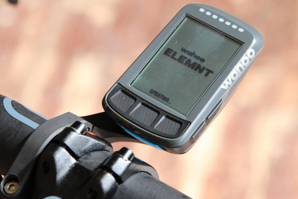
Your article makes it sound like only Garmin and Lezyne use multiple positiining services. Wahoo specs say theirs use GPS, Glonass, BEIDOU Galileo, and QZSS.
I think the most disappointing aspect of Garmin devices is the very poor ability to plot a course from the device itself. I have seen distances more than doubled and routes made tortious. Considering Garmin make satnavs for cars that work well I don't understand why this aspect of the cycling equivalent is so poor.
They always seem to be so much money for such poor UXs. I tried a Garmin 800 (I think) and wasn't impressed.
Someone on here suggested the OSMand app. it is free, does turn by turn directions if it doesn't drive out mad, has countdown to next turn on-screen, and I have old andoid phones floating around. I've been impressed (navigation use, not connecting to trianing aids).
One tip - use an old phone with a physical button (Samsing S5 in my case now) so you can turn the screen on when you want to check you are stil on route. Previously I used a device with no physical button and it was a pain finding the side mounted power button to put the screen on.
You could hook it up to a dynamo hub for charging too if you wanted.
My normal phone stays in my back pocket.
Re: altitude - would have thought that an app like strava, which has firstly the data from the maps it uses, and secondly in most cases thousands of data points from people's devices to average together, would have a pretty darn accurate measure of altitude gained on a given hill. Box hill for example must have 10,000's of measurements reported. So if you climb it the whole way without doubling back or whatever then would think it's better to use their average figure rather than what your single barometer reading gives. Extrapolate that to the majority of the ride and fill in the gaps from the barometer where necessary.
Using a Garmin 530 is like trying to solve a rubix cube every time you want to do anything. I wish I'd brought the touch screen 830 or a wahoo. It does have great battery life though,
Another one for you: even if your device has a barometric altimeter the app that you sync with can step in and override it. Lezyne does this so you have one number in the device, another in the synced ride from Lezyne's "truthing" algorithm in the app/on the web, a third when you sync to Strava and a fourth if you opt to "correct elevation" in Strava. Each one isn't consistently higher or lower than another, though Strava's corrected elevation seems to be the most consistent for a route ridden regularly.
I have a Garmin 520. Honestly, I wish it would die so that I could justify a replacement from a different company. Most of the time, it works just well enough for me not to throw it into a hedge. A fifty quid landfill Android phone has better GPS, routing and mapping (and did at the time of the 520's release). Why does my Garmin take minutes to get a GPS lock when a) my phone gets GPS lock in seconds and b) the Garmin is connected to the bloody phone via Bluetooth and could get its location from the phone? It's just crap, considering what it cost.
I suppose the phone will download ephemeris data from the web and so have a big advantage getting a gps lock.
I realise this, but the Garmin could download the same data using the Bluetooth connection to the phone, or simply get the location from the phone via Location Services. Neither method requires hardware. I don't know if non-Garmin GPS devices do this, or simply get a lock faster than the 520, to be fair to the steaming pile of...
Can't comment on the 520 as I have never had one, but if I switch my 520plus on when I start to move the bike out of the house, it is all set up, GPS connected and ready to ride before I have finished getting it outside and locking the door ... which takes maybe 45 seconds tops.
My 500 takes another 30 seconds or so beyond that to be ready to roll.
Maybe the 520 just has older hardware.
I have a 520Plus and love it. Works well and hasn't given me any grief.
As far as the question I have quoted is concerned ... your mobile phone is also getting location data based on triangulating itself with the signal from the closest cell towers. The phone can show you that pretty much instantly and then the GPS signal take over once the satellite connection has been made.
As to why the Garmin doesn't get the location from the phone ... dunno. Not sure that would work quite as well as GPS if it is using the cell tower location.
Thanks for your comment. Someone local to me is selling a 520 for £80 and I thought "hmmm, perhaps it's a bargain... OTOH is it cheap because it's sh*t?"
The only complaint I have for Garmin's is the way the tabs snap off when riding over a rough bit or road (which is most roads here in the UK). I’ve had it happen to an -800, a -1000 and a -1030. I had to use a racewear repair on the -800 and -1000, which means the unit now stands up prouder on my out front mount. The -1030 was only 6 months old when it happened so was replaced under warranty. The other issue with the -1030 is if you use a repair such as the raceware one it would cover the connections on the base (for extra battery).
Considering how many years Garmin have been making GPSs with this mounting system you’d think they’d have it sorted and robust enough to withstand normal use by now. Surely it would be better to either make the tabs thicker and stronger or make them out of metal. Then the wear would occur on the handlebar mount insert, which is replaceable for a fiver.
PP
only complaint I have for Garmin's is the way the tabs snap off when riding over a rough bit or road (which is most roads here in the UK)
Although this is off topic, these companies seem to produce rubbish mounting kit even when the main hardware is pretty good. The GoPro Hero 7 is technically good, but the PC software is dire so can't be recommended for cyclists who want to submit videos to the generally uninterested police. Equally annoying are the absolutely crap clips which link the camera to the helmet or chest harness- these are made of deliberately useless (I can't explain it any other way) plastic which cracks in months, and then the entire prong breaks off. This contrasts with the very similar rucksack clips which lock into the female component to hold the sack lid down etc.- those last for decades. This can only be to charge for replacements, although it's a short sighted policy as I won't be getting another GoPro.
There is also an altitude problem with Wahoo and Ride with GPS where the later is used to plot routes. There is a differrence in the sampling which means that the Ride with GPs can give different climbing figures on planned routes to those recorded on the actual device. The difference is not insignificant and can be as much as 25% short on Ride with GPS compared with Wahoo.
I looked at a lot of different GPS units that had turn by turn directions for touring purposes, and I heard a lot of complaints, the biggest issues was battery life, and life of the actual unit itself being 3 to 4 years on average from what I could tell from reading. What I found though is that NONE of the cycling reviews ever mention Garmin Etrex 30 and a couple of others that are similar, these units do have turn by turn directions, the battery life is around 25 hours on AA batteries, and from what I've read the reliability of the units are far more then the bike specific ones. I'm pretty sure I'll be going with an Etrex or something similar as soon as I study more about them.
They do get reviewed, but the emphasis is mostly on navigation - they have no ability to connect to most of the sensors that might be of interest to the more training oriented or nerdy users, so that limits the appeal to many. As a straight digital map with a few extras, they seem to be reasonably well regarded, they're just somewhat lobotomised outside of that usage.
Well since it's not going to be used for training I'm find with that. But I think the Garmin Touring Plus (note I said I think) isn't made for training. The Etrex 35 seems to have everything I need. Of course since I've been studying these things I found out that most people that tour do not rely on these GPS things exclusively, they also use good old fashion paper maps supplied by Adventure Cycling, so they can reference two different things to get a better idea of what's going on.
I'm not done researching these Etrex type of units, there are other models to like the Oregon, Montana, GPSMAP 64, not sure why they have to have so many models, probably to confuse the crap out of the consumer. Anyway I need to check into all of those before I make a decision.
GPSMAPS 64S is almost totally unsuitable for bike riding. It's designed for trekking, there's no easy way to safely mount it on a bike, short of getting a RAM-mount. It's also heavy. Other than that it's good, screen is perfectly legible and if you don't need performance data it's more than enough. On fully charged high-capacity batteries and with the screen on average backlighting (you don't need any backlight during the daytime, only at night) it lasts 10 real hours. I actually mounted it on a bike for a year and got along fine but together with the RAM-mount, it added 600 grams easy. Just after two years, my unit simply died on me. It was out of warranty but, I contacted Garmin anyway and they told me to ship them the unit and they'd give me a quote. Two weeks later I received a parcel that contained a brand new unit, together with a note saying that mine had a factory defect and was replaced for free. After another year I caved and got myself a 1030.
I love my wahoo and my black and white tv for watching the snooker - c'mon Higgins!
Who remembers, "And for those of you watching in black and white, the pink is next to the green," by Ted Lowe iirc?
99.9% of these issues are Garmin device related.
Buy a Wahoo bolt and forget the worries
Pages