Sustrans removes / redesigns 377 barriers on the NCN

  • Creator
    Topic
  • #32807
    mattw

    From the Sustrans Annual Review which dropped recently (and I only just skimmed):

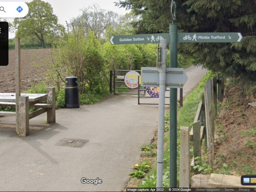
    Improving accessibility on the Network There are thousands of restrictive barriers on traffic-free sections of the Network that prevent many people from accessing and enjoying their local routes. This year we removed or redesigned 377 barriers across the country, exceeding our target of 218. This included 106 on our own land. Thanks to a phenomenal effort from our volunteers, we also audited and mapped every remaining barrier along 5,100 traffic-free miles, so that we can better understand whether they need to be removed or redesigned. 

    I think that makes it around 1000 since they started implementing this initiative in ~2020.

    For context, their audit of the 13,000 miles of the NCN in 2018 identified 16,000 barriersm, so there is a long way to go in a project aiming to be finished by 2040. 

    Imo this is heroic work, and I don’t know any other bodies ocmmitted to doing this, and it involves co-ordination with landowners, councils who are having their budgets slashed and local groups.

    Meanwhile, I noticed this week that the 11.5 mile towpath of the Erewash Canal, which is mainly decent-ish quality and width (liable to be a little damp at the River Trent end), but is littered with K-Barriers (I am told), consists entirely of Public Footpaths (ie Rights of Way).

    “Afaics the entire length of the towpath to the Erewash is a public footpath, and therefore a PROW. Derbyshire, unlike Notts, has their definitive map online and this is Sawley FP20, Long Eaton FP33, Sandiacre FP19, Stanton by Dale FP21, and Ilkeston FP81.”

    So that means that a couple of legal tools are available to get rid of said barriers which do not straightforwardly apply to permissive paths – the Equality Act 2010 and Section 130 of the Highways Act 1980 (as used by the Ramblers).

    If it’s good weather tomorrow I may go out and survey it from my cycle, with the aim of gently plotting to get rid of these barriers.

    Link:
    https://www.sustrans.org.uk/media/12437/sustrans-annual-report-2022-23.pdf

Viewing 15 replies - 1 through 15 (of 22 total)
  • Author
    Replies
  • #1020621
    mattw

    H’okay. I’ve had a look at

    H’okay. I’ve had a look at this. Apols for a long response; there are a number of ways potentially to skin this cat.

    Facts

    1 – It is on NCN23, as you say. Therefore Sustrans should be interested.

    2 – It is a Council signposted walking / cycling route since I guess the 80s or 90s, proven by Streetview back to 2008-9, with drop kerbs. Therefore it is a service to the public under EA2010, with equal access required for all and the Public Sector Equality Duty potentially engaged especially with the drop kerb removal. Litigation risk for Council under EA2010.

    This is probably County not Borough, as the LHA does Public Rights of Way etc.
    https://www.google.com/maps/@51.2463642,-1.0990709,3a,87.5y,268.05h,60.35t/data=!3m7!1e1!3m5!1sh5xuZ0hJ1BvXQmu_LQ4jAQ!2e0!5s20090801T000000!7i13312!8i6656?entry=ttu

    3 – It is a Public Footpath, ref FP 013/506/1 on the Hampshire Definititive Map and Statement. Ditto service to the public, and also Highways Act 1980 S130 should be engaged. Bottom RH corner of this sheet, labelled 506:

    https://www.hants.gov.uk/rh/row/maps/1521.pdf

    4 – In addition to no drop kerb, it also seems to have (Streetview) unlawful chicane barriers both ends. Unlawful obstruction on a PROW ref point 3?

    (To address these you will need a brief survey with dimensions (path width, gaps, overlap, longitudinal pitch), evidenced photographically.)

    5 – The development is recent, with Planning App no 23/02095/FUL, but contains little reference to maintaining the footpath except for • New links with existing public transport and footpath/cycle route network” in Section 7.3 of the Design and Access statement.
    https://planning.basingstoke.gov.uk/online-applications/applicationDetails.do?activeTab=documents&keyVal=QH0JLSCRLJP00

    6 – But there is this is in Planning Condition 19 in the Approval Notice. “Footpath” not “footway” sounds like a reference to the Public Footpath to me. It has not been reinstated to status quo ante, in that cycles and pedestrians with cycles as a mobility aid, mobility scooters etc are now prevented from accessing the pre-existing cycling path.

    19. No part of the development shall be brought into use until all existing redundant accesses have been permanently close and the footway crossings removed and footpath reinstated. REASON: In the interests of highway safety and in accordance with the National Planning Policy Framework (February 2019) and Policies CN9 and EM10 of the Basingstoke and Deane Local Plan 2011- 2029.”

    That sounds potentially enforcible at developer expense to me, but  would need Planning Enforcement may ask the developer to sort the drop kerb.

    Suspect this has fallen down the “sweat the detail, what’s a Public Footpath or a Pedestrian” gap between County, who do PROWs, and Borough, who do Planning.

    7 – Basingstoke has local elections on May 2nd 2024. So local councillors may be amenable to lobbying.

    8 – I suspect the underlying issue here is a carbrained Council who hope that these type of access questions are dogs that can be left to lie, quoting Schrodinger’s Motorcyclist. Our job is to get access, and prove that this assumption is a lie.

    What to do with some or all of these?

    I’m afraid there’s some spadework here, but that is always true.

    1 – Get some people whom it causes problems for to complain to their local Councillors pronto eg it stops me getting to work as easily. Mainly County as the people who supervise the LHA, but also District or a District Councillor will whine when a County Councillor does somethingideally also stating that this will affect their vote in May.

    Remember Councillors get their own small discretionary budgets usually, which might be enough to fix this (certainly the barriers). Ask, or get 5 people with local votes to ask.

    2 – Keep the kerbs and the barriers separate if you feel it is necessary.

    3 – Put in a submission via the Sustrans contact form asking them to intervene; they have more clout and relationships.

    Sustrans have a barrier removal toolkit – both no drop kerbs and chicanes count as Barriers.
    https://www.sustrans.org.uk/about-us/paths-for-everyone/barriers-on-the-national-cycle-network/how-to-get-barriers-redesigned-or-removed/

    4 – Local cycling campaign may help – you have probably done this. Also Ramblers may be interested – most groups have PROW Compliance Officers who exist for this type of problem.

    5 – If you are a member of CUK, Ramblers or Open Spaces Society, engage their professional campaign / support networks on these issues.

    6 – Perhaps reach out to Wheels for Wellbeing – they are active on this issue and quite authoritative, and happy to send ‘one of our supporters told us about this problem …’ type emails. Their #BashtheBarriers page with lots of references is here:
    https://wheelsforwellbeing.org.uk/bash-the-barriers/

    (If you find them helpful, please make a donation.)

    7 – Approach Planning Enforcement, ideally with Councillor support. They like other people to pay for things.

    8 – If you are up for strategy, try and make a claim under prescriptive use for 20 years for that to be a Public Right of Way for cycles and put on the Definitive Map. It makes it more difficult for a right of use to be taken away by eg the Council removing the signs. That *will* needs your local cycling group engaged.

    9. If someone starts on Scrodinger’s ASB Motorcyclist, there are loads of videos out there showing physical barriers do not work, and also this Appeal Court case esp para 41:
    https://www.bailii.org/cgi-bin/format.cgi?doc=%2Few%2Fcases%2FEWCA%2FCiv%2F2021%2F1098.html

    There’s loads more, but these are a few thoughts.

    #1020619
    Jpennycook

    It would be great if they

    It would be great if they could persuade councils to not install NEW barriers on NCN routes.  Hampshire County Council decided that where a shared use path from Hatch Warren Way in Basingstoke joins Jays Close, the last few metres isn’t itself a shared use path, so when a developer building some warehouses removed a car park entrance road where the dropped kerb was, and built a section of pavement to replace it, the Council said there was no need to provide a dropped kerb, so now I either have to dismount, or go a different way.


    The NCN23 through Hampshire is not particularly good (busy roads, barriers too close together, narrow shared use paths, not particularly direct)

    #1020615
    mattw

    I think I covered that one in

    I think I covered that one in my other comment :-).

    All such programmes follow an S-curve:

    The start was 2020. I’ve had a chance to look back throught the previous years.

    Year   Barriers Removed/Redesigned

    2018-19 Setting Plans
    2019-20 31 barriers removed / redesigned
    2020-21 242 barriers removed / redesigned
    2021-22 423 barriers removed / redesigned
    2022-23 377 barriers removed / redesigned

    I make that 1073 so far. I’d sall that a “good start”, but the rate needs to go to 800-900 per year to meet the 2040 goal.

    #1020617
    mattw

    I agree with that.

    I agree with that.

    Google does have a facility where certain cycle paths have been recorded – I am not sure how it works.

    Here is an example for the Lancaster Canal towpath near Garstang:
    https://www.google.com/maps/@53.8963747,-2.7766525,3a,75y,128.5h,81.83t/data=!3m6!1e1!3m4!1sFFpD2ie9awHtkQ5lNDXl0A!2e0!7i13312!8i6656?entry=ttu

    #1020611
    bob.sweet

    I think Sustrans may have a

    I think Sustrans may have a problem with their maths. 16000 barriers in 2018, to remove them all by 2040 requires 727 per year. So a target of 218 is 73 years, that is 2091. I don’t think many of us will see that completed.


    https://cdn.road.cc/wp-content/uploads/roadcc/Capture_95.JPG

    #1020613
    bob.sweet

    I think it would be good to

    I think it would be good to have a google streetview type record of each of the paths. But it may need ones for different months. Riding a path in January is nothing like riding it in August.


    #1020609
    hawkinspeter
    chrisonabike wrote:
    Should be an “image” thing at the bottom of the editor (well – there is in my one anyway.

    You can also reference already-uploaded images but ICR the syntax just now, andystow had that all worked out…

    In Firefox you can right-click an image and choose “Copy Image Link” and then put that between two IMG tags in square brackets

    https://cdn.road.cc/sites/default/files/styles/main_width/public/chester-millenium-gateway-mickle-trafford-chicane-barrier.jpg

    #1020607
    mattw

    Thanks for the reply. The UK

    Thanks for the reply. The UK situation as I see it is:

    1 – We have excellent standards in LTN1/20 (but need an update – eg for CYCLOPS junctions).

    2 – But they are Guidelines, not Mandatory – which needs to change as it is still routine for infra to be built to 10-20 year out of date standards. eg Painted lanes on 40mph roads.

    3 – On these barriers (my issue) they install because it looks like action as a sticky plaster to fix a poor or substandard basic design * .

    The police sometimes support them, even when unlawful under EA2010 – suspect because it again feels easy, and comes out of a LHA budget not their own. We need policing priorities adjusting.

    * An example is the Kerplunk Barriers. I went to survey that , and the real problems are that the pathway design is crap because a) It has a 1 in 12 slope, 2) The surface is skiddy grit over a hard surface so braking is near impossible as wheels, 3) The path design is straight not serpentine, so speed is not inhibited, 4) Sightlines are poor.
    https://road.cc/content/news/cycling-live-blog-15-january-2024-306191?page=1

    4 – No one keeps records, which is an artefact of short-termism / no 30 year cyclic highway maintenance in UK.

    I literally know of ZERO Highways’ Authorities who know where their anti-wheelchair barriers are. I have put in FOIs to several.

    So there are barriers everywhere that are 20, 30 or 50 years, and the LHA have forgotten, and the locals were told “they stop motorbikes” and swallow the folk-myth, and then fight to keep them. As do Councillors.

    5 – So wheelers and cyclists get excluded in practice from paths and cycleways, and are therefore forced back onto roads.

    Therefore we need to work to recover lost paths, as well as creating new ones – which brings it back to why I try and fight a war on barriers, and give credit to Sustrans who are doing much.

    #1020605
    don simon fbpe

    Diolch, that makes it more

    Diolch, that makes it more understandable and I would suggest that the chicane itself is not suitable for a vehicle of 1.2m x 2.8m. The length isn’t a problem for accessing the road as there is more than 2.8m between gate and road. The chicanes that were placed to restrict speed near a school have been replaced to allow greater accessibility and the anti-cycling signs have now gone too. These signs create division as it empowers dog owners to believe that it is the cyclist that carries full responsibility. The number of people who rely on these signs as fact and refuse to look at the Highway Code is not surprising in modern day england. That section of the path is quite horrible to ride and I would say is more of a problem of accessibility (I don’t ride so I can be involved in altercations with dickheads) as on more than one occasion I have turned around as I haven’t been in the mood for these people, I have experienced other cyclists having to stop because of out of control dogs too.

    #1020603
    mattw

    It’s quite difficult to

    It’s quite difficult to comment without precise dimensions – and as I say it’s under a tree so I can’t estimate from Google Maps.

    The cycle design vehicle which is required by LTN 1/20 to be able to access the Greenway is 1.2m wide x 2.8m long, which is the width fo a side by side tandem and the length of a cycle plus trailer. Detailed reference below *.

    In practice this means that chicanes must be at a minimum approx 1.5m gaps with no overlap of the blocks, and the blocks to be separated by 3.5m longitudinally.

    I never understand why such paths are made so anrrow as to guarantee conflict, when they usually have a rail track corridor to work with. But they always go for the absolute minimum.
    ————————————–

    Cycle types, sizes and movement, including minimum route dimension requirements

    The Cycle Design Vehicle is a key design concept for accessible cycling provision: It helps ensure cycle provision caters for most real-world cycles by requiring routes and parking to be usable by riders of a vehicle 1.2m wide by 2.8m long, and with an external turning circle radius of 4m. This matches the width of a side-by-side tandem and the length of a standard bicycle plus child trailer.

    See chapter 5 geometric requirements, especially:

    2.1 – dynamic kinetic envelope – space for cyclists to move,
    4.1 – dimensions and types of cycles,
    fig 5.2 – typical dimensions of cycles,
    5.2 and tables 5-2 and 5-3 – minimum widths of cycle tracks, including additional width at fixed objects
    7 and 5.8 – stopping sight distances and visibility
    10 – crossfall and camber
    11 – edge protection

    https://wheelsforwellbeing.org.uk/wheels-for-wellbeing-guide-to-ltn1-20/

    *

    #1020601
    don simon fbpe

    You’ll have to explain how it

    You’ll have to explain how it restricts access to the pathway or leaving (in any way greater that a motorised vehicle joining at a junction with either STOP or GIVE WAY sign. It currently works very well. Treat it as any other junction.

    My beef is the anti-cycling signage that has been allowed to be put up without any such nod to the Highway Code for dog owners, which are by far the most entitled users of this particular path and probably a huge risk to path users. My thoughts on clubs using this path (and by default STRAVA segments) has been made clear on other threads.

    #1020599
    mattw

    It’s a problem if it

    It’s a problem if it restricts any access to the pathway, and its existence is an admission of a poor design of the junction. I can’t evaluate the chicane itself as it is under a tree for satellite view.

    The alternative imo is to design it to be safe, which could have been achieved by having a curved path for the last 10-12m, and perhaps a partial fence along the roadside for the straight path along the greenway.

    The other thing that sticks out a mile is that there is nothing to mitigate the behaviour of motors, such as warning signs, road markings, change of surface etc.. Yet there seems to be gallons of paint sued for other markings.

    It’s a pity that pedestrians are forced to walk in the road, when it is so close to the centre of a village and there are sections of footway close by.

    #1020597
    don simon fbpe

    not being able to set

    not being able to set orientation is pretty crap too…

    https://cdn.road.cc/wp-content/uploads/roadcc/IMG_0153.jpeg

    #1020595
    don simon fbpe

    Another, and yes, not

    Another, and yes, not allowing multiple images is sooo 1990!

    https://cdn.road.cc/wp-content/uploads/roadcc/IMG_0152.jpeg

    #1020593
    don simon fbpe

    diolch.
     

    diolch.


    https://cdn.road.cc/wp-content/uploads/roadcc/IMG_0154.jpeg

Viewing 15 replies - 1 through 15 (of 22 total)
  • You must be logged in to reply to this topic.