


With their ability to run a huge range of useful cycling apps, smartphones have revolutionised cycling. With more capability than the humble bicycle computer, the smartphone allows you to easily track and record rides, plan routes, keep on top of your training, and much more besides.
-
There’s a vast range of cycling information and help available through your smartphone, from navigation to planning and tracking your training.
-
Your smartphone can take the place of a bike computer or GPS — and take calls as well (remember those?).
-
Data from your rides can be saved and uploaded to websites linked to apps so you can monitor your progress and compare your rides against others’.
-
There are also apps for handy things like fixing your bike and even setting up your bike fit
29 of the best cycling apps
- Navigation & location
- Ride logging
- Useful information, tourism & points of interest
- Bike tech, repair and maintenance
- Calorie counting
- Ride information
- Weather
This is a list of some really useful cycling apps currently available, covering navigation, planning routes, fiixing your bike and more. We also have a separate guide to the best cycling training apps, which we’d recommend checking out if you need an app for indoor cycling or if you’d like to crunch your ride numbers (inside or outside) in more nerdy details.
Navigation & location
what3words — free
The application of what3words goes way beyond cycling, with its revolutionary way of talking about location already receiving rave reviews from emergency services and the public alike.
Instead of addressing the world by postcode, the app has assigned 3-word addresses, spaced by a full stop between each word, to each 3×3 meter square of the earth (there are 57 trillion of them). It’s a much more accurate way of describing a location, and whole new way to talk about where you are. No more vague descriptions of somewhere you went and can’t quite remember where it was, just three words that pinpoints the exact spot.
The clever algorithm makes sure addresses that sound very similar are far apart, and more common address are given to built-up areas while more obscure ones are given to rural and remote locations to better distinguish them. It uses a range of different languages, and more are been added over time, with a word list of over 40,000 in English. To avoid confusion, no words are shared between language versions. Once they find a 3 word address in one language, they can switch languages and discover the 3 word address for that same 3m x 3m square in a different language.
So, if you ever want to meet a mate on a trail buried in the woods or need to ride to an address that is difficult to find by postcode, they can use what3words to assign their location a three-word ‘address’, and you can use the app to direct you straight there.
Komoot — free for one region, additional maps from £3.99

Boldly proclaimed as “the world’s best route planner”, Komoot turns your phone into a proper sat nav with voice commands. You can key in your location and where you want to get to before your ride, which Komoot saves as a planned journey, and then it records your activities as ‘completed tours’.
Where it differs from other navigation apps is the routes, as Komoot will often give you numerous options for reaching your destination, that aren’t always the quickest. It’s a good app choice for the more adventurous bike tourer, off-roader or just a long commuter who wants to explore a new route home.
Komoot now includes Garmin Route Sync, so it can automatically send any route you create to any Garmin device that supports .fit files, which is pretty much every Garmin back to the Edge 500.
Komoot is available for both Android and iOS devices
CycleMaps: Cycling Route Planner & Navigator – free

If planning routes and also using shared routes is of interest to you, then CycleMaps could be worth checking out. It’s being constantly updated with a large database of routes. It lets you store favourite routes and import GPX and KML routes, and shows all cycle paths. It’s also compatible with the Apple Watch.
Available for iPhone only.
CycleStreets – Free

Planning routes is where apps can be really useful. This one lets you plan routes from A to B anywhere in the UK with three routing modes to suit different types of cyclists, from commuters to beginners.
Ride With GPS

Here’s a very powerful route planning app, and very popular with cyclists planning long-distance rides. As well as really good route mapping tools, the app can be used as a cycle computer t provide navigation and live tracking, and even supports Bluetooth accessories for adding heart rate, cadence and speed data.
Google Maps – Free
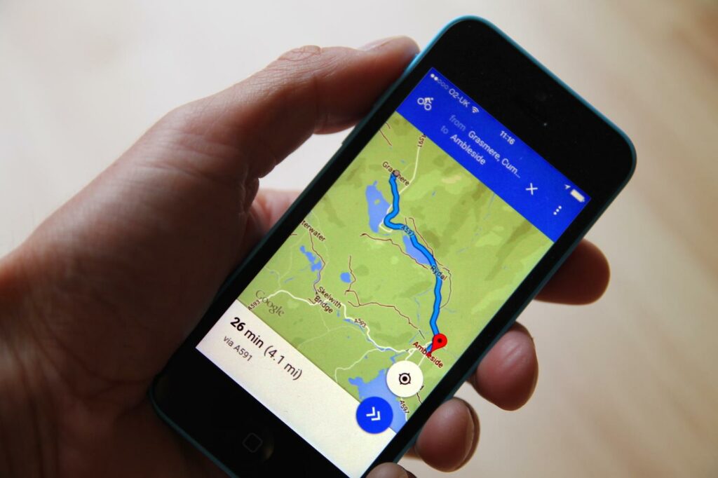
There are many mapping apps available but one that you might have on your phone already, and not realise it, is Google Maps. The latest version has offered cycling routes for some time, and works very well. It can provide turn-by-turn navigation instructions if you want it as well.
MapMyRide – Free, in-app purchases
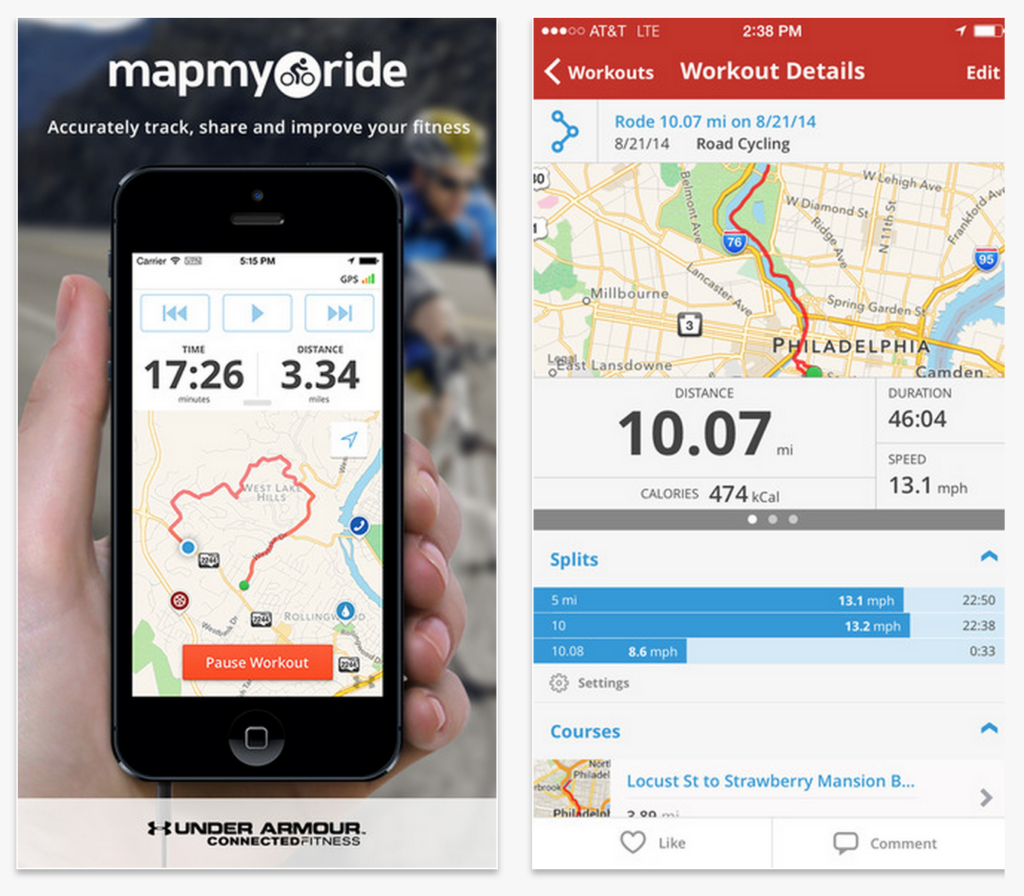
MapMyRide has been around for quite a while and is a very popular way of plotting routes or finding other routes in your area, with a large database of routes available, making it a good option for those wanting to explore a part of the country. It’s free but there is a premium version which gives you more advanced tools and mapping.
Ride logging
Strava – Free, in-app purchases
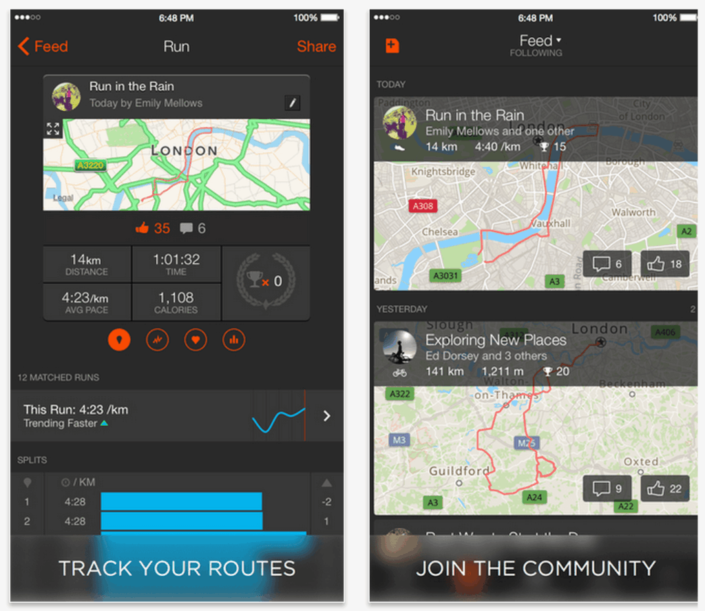
Here’s an app that almost certainly needs no introduction. Yes of course, we mean Strava. Since it launched in 2009, Strava has gone on to become hugely popular and for many, it’s the go-to app for all cycle rides. The smartphone app tracks and records your ride, providing distance, speed and other metrics, but it’s how your rides are presented that sets it apart. ‘Segments’ show your times on leaderboards so you can see how you compare to others who have cycled the same road, and the social functionality that allows you to follow the weekly progress of cycling friends, join clubs and take part in challenges that really is the reason for Strava’s unrelenting popularity.
Strava now includes Garmin Route Sync, so it can automatically send any route you create to any Garmin device that supports .fit files, which is pretty much every Garmin back to the Edge 500.
Available for iPhone and Android. You can also join clubs, road.cc even has a club, you can join us here
Garmin Connect Mobile — Free
If you use a recent Garmin Edge GPS unit, then you’ll find Garmin Connect Mobile useful. It can connect to your device to upload your rides to the Garmin Connect website, which can then share your data with Strava and MyFitnessPal. You’ll need it if you want to use Garmin’s LiveTrack feature and let someone know where you are while you ride.
Garmin Connect Mobile can send stored workouts via Bluetooth to most current Garmin Edges too, though you’ll need to create them on the Connect website first.
Most people will probably find that the app’s most useful feature is its calendar. If you own a Garmin Edge cycling computer – a 520 or an 820, for example – the calendar allows you to review rides you’ve done in the past, using the app as a detailed training diary.
Garmin Connect now includes Garmin Route Sync, so it can automatically send any route you create to any Garmin device that supports .fit files, which is pretty much every Garmin back to the Edge 500.
Read more about Garmin Connect Mobile
Available for Android, iOS devices and Microsoft Windows 10 Mobile.
Relive — Free

Relive captures your ride data from Strava, Garmin Connect, Endomondo or Polar and transforms it into a stunning moving map. Any ride of 10km or more for a duration of 12 hours or less can be uploaded. After your ride has been shared to your logging service, Relive sends you an email with a link to your video.
Available for Android and iOS devices.
Useful information, tourism & points of interest
Refill — free

Refill is a super handy app that allows users to find locations where they can refill water bottles for free, now with over 20,000 locations nationwide and growing
Refill is available for Android and iOS devices.
Beanhunter — free

Beanhunter started out in Australia and the app has now grown to offer a pretty comprehensive database of cafes worldwide. Just download the app and search for either cafes nearest to you or anywhere else by name and/or location. You can share your experiences by uploading photos and opinions on the cafes you’ve visited, leave reviews and read reviews from others if you’re looking for an extra-special cafe stop to impress your ride group. If you find a previously unlisted cafe that deserves shouting about you can upload a listing yourself, and to find cafes the app redirects to your default mapping application.
Beanhunter is available for both Android and iOS devices
Bike Citizens — city guides from ~£3

Bike Citizens is a navigational app and a travel guide in one, providing a huge, constantly updated database of maps worldwide and plenty of tips and points of interest for making the most of your visit to a new destination if you plan on getting around by bike. It won a Eurobike Award in 2015 for being a ‘must-have’ innovation, so isn’t without plenty of recommendations.
The Bike Citizens map material is based on OpenStreetMap, which is always evolving and you can also add routes to its database yourself; meaning there are plenty of interesting user-submitted rides to check out on the app. The route planner has voice commands so you needn’t be staring at your phone while trying to navigate, and it will choose routes with varying levels of gradient according to what your preferences are. There are over 450 European cities on its database, with many others worldwide.
Bike Citizens is available for both Android and iOS devices
Santander Cycles – Free
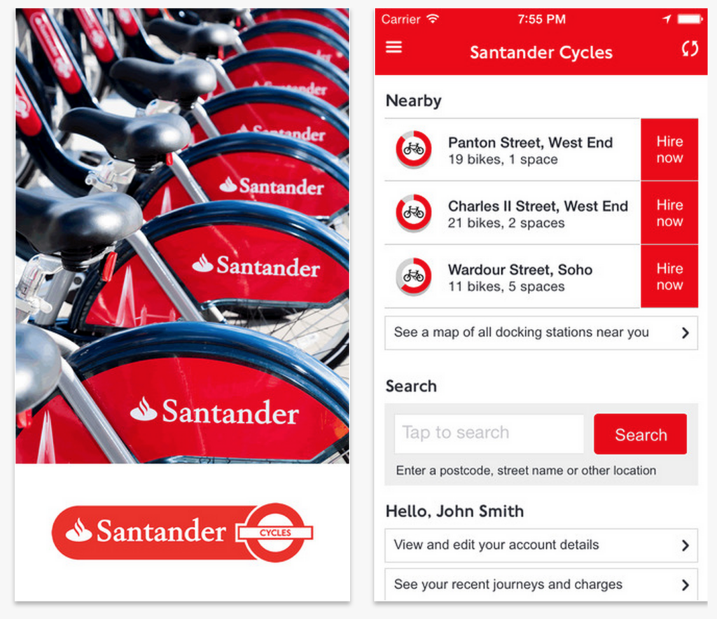
This is the official app for the Cycle Hire London for Santander Cycles bicycle hire scheme and allows you to find your nearest bike and docking station. As well as that, it can plan routes for you, able to offer either the quickest or quieter roads depending on your preference, with handy turn-by-turn instructions. The app usefully has a built-in timer so you can keep on eye on any usage charges that might occur.
Fill That Hole – Free
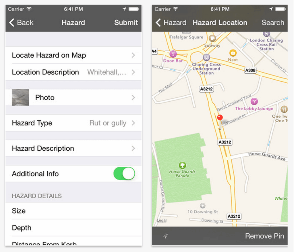
Cycling UK launched the Fill That Hole service for reporting potholes to local authorities a few years ago (when they were still called CTC), making it easier than trying to find the right department at your local council to flag up a dangerous pothole. The app lets you easily report a pothole, so you could do it from the side of the road instead of waiting until you get home and logging onto the website.
St John Ambulance First Aid for Cyclists – Free
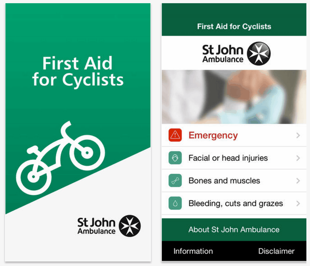
What do you do in an accident? It’s not a position anyone really wants to be in, but the First Aid for Cyclists app by the St John Ambulance aims to equip cyclists with essential and basic first aid skills to combat the most common cycling injuries, whether it’s road rash, cuts or head injuries.
Bike tech, repair and maintenance
Bike Gear Calculator — £1.99 or free for basic version
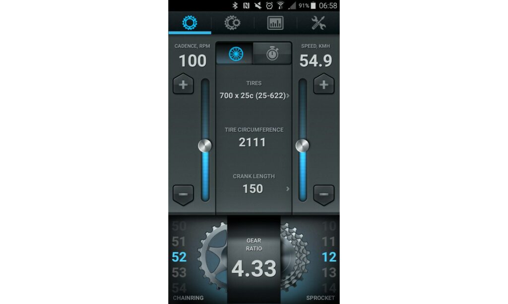
Bike Gear Calculator is a quick way to compare different gears on your bike and on setups you’re considering, and for seeing how fast you’ll be travelling in a given gear at a particular cadence (pedal revolutions per minute).
You just add details about your bike and all the maths is done for you. Of course, you could do the calculations yourself, or use something like Sheldon Brown’s Gear Calculator, but this app makes things fast and simple.
A free version of the Bike Gear Calculator is available, with £1.99 getting you a more advanced edition.
Read more about Bike Gear Calculator
Bike Gear Calculator is available for both Android and iOS devices.
Haynes Bike Repair Guide — £1.99

This bike maintenance app from manual specialist Haynes has everything you need in one place to perform most tasks. There are step-by-step tutorials including videos for all the jobs, and it’s also updated with fresh content each month.
Walk-throughs of tasks performed pre-ride include checking the front hubs, checking the cockpit, frame checks and a drivetrain inspections, and there are detailed installation and repair instructions for every part of your bike from chainrings, to bottom brackets to truing your wheels. There are over 40,000 words and dozens of videos featured in the guide.
Read more about the Haynes Bike Repair Guide app
Haynes Bike Repair Guide is available for Android and iOS devices.
AeroAPP – ~£90/yr (basic version free)

AeroAPP is an app for Garmin’s ConnectIQ platform, so you’ll need an Edge 520, 820, 1000, or 1030 GPS computer, plus a power meter. With it you can perform a simple test to compare the aerodynamics of different bike setups. It’s not cheap (though it’s recently had a price cut from the previous £180/year), but if you’re seriously into your time trialling or want to optimise your luggage for endurance racing it’s still a lot cheaper than the wind tunnel.
Bike Doctor – from £1.79
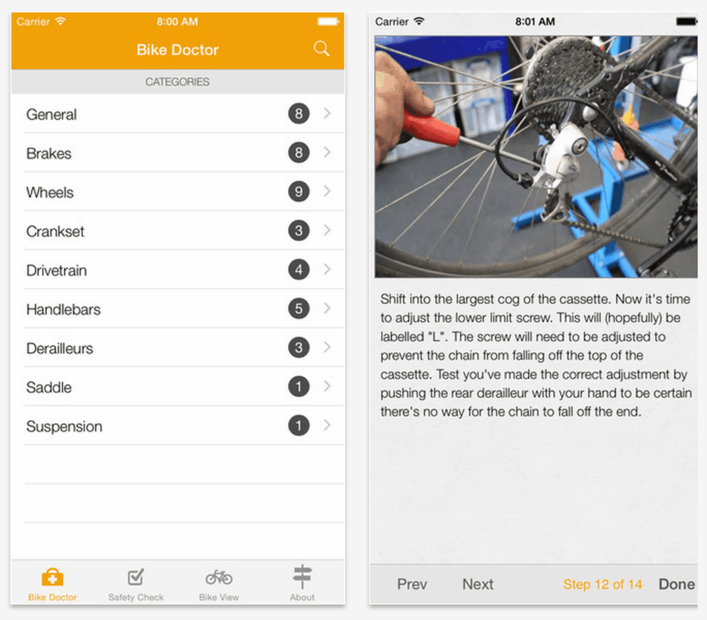
Maintaining, servicing or fixing your bike can be a little daunting at first, and that’s where this extremely useful app come comes into its own. It provides step-by-step instructions for fixing any sort of mechanical problem on your bike. It’s been designed to be easy to use, with clear instructions that even a complete beginner can follow.
It costs £3.99 on iPhone and £1.79 on Android. Cheaper than visiting the bike shop though
Size My Bike – £3.77
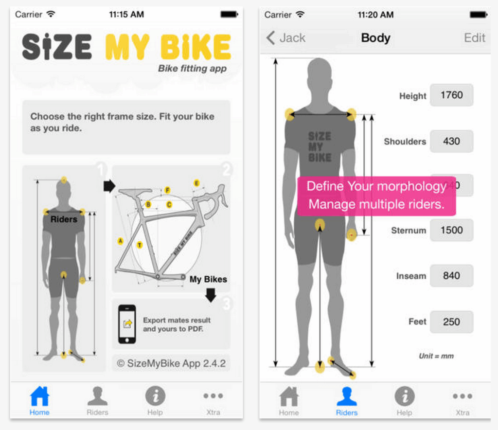
Determining the right size road bike, especially if you’re a beginner or buying a bike online, can be a tricky decision. Size My Bike is a bike fitting app that uses six body measurements to help you choose the right size road bike. It also works for mountain bikes too.
It costs £3.77 on Android and on iPhone.
Bike Fast Fit – £3.99

Here’s another bike fitting app. It lets you capture some riding video, on a static trainer, and measures key riding position angles and distances to provide analysis of your position.
Available on iPhone only
Calorie counting
Lifesum — £2.92/month

Lifesum is a really good app to use if you want to shed some weight, or just track your basic food habits and exercise day-to-day even if you’re in tip top shape. Add in the basics such as your gender, age, weight and you’re good to get started on the free version of the app. You can input your meals and activities (the food options are endless so it’s unlikely you’ll need to make custom options for many things) and the app tells you what you need to eat to stay on track according to your goals.
Lifesum is available for Android and iOS devices.
MyFitnessPal – Free, in-app purchases

MyFitnessPal aims simply to help you lose weight by making it easy to track calories on a daily basis. A database of over 4 million foods makes it easy to track how many calories your meals are providing. It can also has a recipe counter for tracking homemade meals too.
Ride information
Bike Computer — Free

Doing what it says on the tin and then some, Bike Computer is a refreshingly simple app that turns your phone into a GPS bike computer. This free app is available on both iOS and Android( app stores and tracks basic metrics including pace, distance, route and elevation.
It’s compatible with Bluetooth-ready heart rate monitors, and all your rides can be shared straight to Strava or Facebook on completion. There’s a dark screen mode which reduces battery use and makes it viewable on night rides; plus Bike Computer Co. claim their app is also 12% more battery-efficient than any other mobile fit tracker on the market, reducing the chance of running out of charge on a ride.
Bike Computer is available for Android and iOS devices.
Cyclemeter
Cyclemeter is a really useful app that turns your iPhone or Android device into a cycle computer, which is really handy if you mount your phone to your handlebars, providing plenty of information at a glance. It integrates maps for navigational duties and can be customised in many ways, including providing audio alerts for a range of metrics.
It’s also available on the new Apple Watch if you have one of those.
Weather
BBC Weather – Free

This is without doubt the most popular app on my smartphone. You can’t be a cyclist in the UK and not obsessively track the weather forecast before a ride, looking for any hint of rain on the horizon or a change in wind speed or direction. The app is free and really easy to use, and provides a good level of hourly and daily detail.
Rain Alarm – free

Unsurprisingly weather apps are popular with cyclists. Who doesn’t check the weather before getting dressed for a ride? Rain Alarm uses real-time data to warn of approaching rain, and provides precise detail on a clear map.
YR.No – free

This is a very popular weather app, with lots of fans. It’s a service from the Norwegian Meteorological Institute and NRK and provides weather forecasts, textual forecasts, meteograms and extreme weather warnings.
Want more cycling apps? Check out all the cycling apps we’ve featured.
Are there any smartphone apps you use regularly for cycling? Let’s hear about them in the comments below.


54 thoughts on “Best cycling apps — download the best apps to complement your bike riding from tracking to finding new coffee stops”
Strava for Social
Strava for Social
Garmin Connect for reviewing data
Training Peaks for scheduling workouts
I like the look of the Fill that Hole app. Would be very useful between Southampton & Portsmouth.
Used to plot routes on google
Used to plot routes on google maps on pc, then recall them on the iphone, but it doesn’t work anymore.
If there is another person,
If there is another person, other than me, out there with a windows phone, try Run The Map. Good when your out, works offline, easy to compare and trend rides, climbs and speed. Also easily integrates with Strava.
Weather’s never that nice in
Weather’s never that nice in Birmingham.
Strava for the usual social
Strava for the usual social and recording……
Rain Alarm for current live rain forecasts….
Weatherbomb for 10 day weather modelling ….
Osmand+ with the new Topo maps for rides….
CycleStreets for city routing…
Yr for 24/48hr Forecasting
works for me
I like the mental challenge
I like the mental challenge of navigating and pacing myself without a screen constantly telling me where I am or what calories I am burning. But I do appreciate being able to use online weather and mapping services beforehand. What I think would be useful would be a comination of the two in one app or web site. Something that would colour-code each section of your route as you plot it, based on the forecast wind direction and strength at each point, given a start time and estimated average speed which you enter. You could then adapt your route to avoid block headwinds, or reverse it if a change is predicted later in the day. Alternatively, you could save a collection of favourite routes, then choose which to take based on a weighted score calculated from the conditions if you start now. Quite possibly Team Sky already have something like this, seeing as they’ve recently gotten much better at getting into echelons.
I pulled up at a set of
I pulled up at a set of lights next to a middle-aged chap with a smart phone mounted on his handlebars running what looked to be some sort of mapping app, so asked him what it was.
“Pokemon Go”, was the answer.
Strava and Fill that Hole don
Strava and Fill that Hole don’t mix
What about the WindowsPhone
What about the WindowsPhone users? (No love for either of them? I’m not one but one of them will be along sooner or later to complain that they’ve been missed out again )
)
edit: I see he’s already been past
If i started to use fill that hole in Scotland that 30 miles ride would take 10hrs ..so no thanks
Strava – good
Rain alarm – really like
I’ve been using komoot for
I’ve been using komoot for the past 2+ years and I’m really satisfied with the ease of use and the pace of its development.
Remember that Google Maps can
Remember that Google Maps can download map areas for offline use so you can locate yourself even if you’ve no signal/data.
The Santander Cycles app is
The Santander Cycles app is almost useful for finding docking stations, in all other respects it’s useless. The available spaces are never, ever accurate.
ViewRanger
ViewRanger
Excellent for plannig routes and navigating…
https://play.google.com/store/apps/details?id=com.augmentra.viewranger.android
Maps.me
Downloadable country mapping to save on data. Cycle specific route planning…
https://play.google.com/store/apps/details?id=com.mapswithme.maps.pro
It’s also good for driving in foreign countries if you have no network coverage.
OS Maps and OS Locate work
OS Maps and OS Locate work well for me – when I’ve got lost or the planned route needs to be changed. Paper OS maps now come with a code that allows you to put an offline copy of the map on your phone. I find it far easier to understand what I’m going to be riding on a OS map than Google maps.
As for trusting Garmin to take me on a sane route …….I don’t think so.
You missed off Uber – for
You missed off Uber – for when things really don’t go to plan!
Anyone used BikeComputer Pro
Anyone used BikeComputer Pro on android?
ClubSmed wrote:
Totally impressed by this. I’m using it on an xperia z3 that I picked up for £40. I recently did a ride with that on my handlebars, alongside a Garmin Edge 1000. The maps and screens are so much better. The gradient data isn’t so accurate, but everything else was spot on. Am gonna sell my Garmins, I think, cos this is soooo much better in everything but battery (and even that’s not a huge difference). I’m getting through 12% of the battery per hour with routing and screen on all the time.
Havent seen anyone talk about
Havent seen anyone talk about windyty. For those of us with deep wheels and when to bust out the 38mm or the 80mm tubulars
I agree with Strava forthe
I agree with Strava forthe social and other metrics. For route planning, particularly off the beaten path, it sucks.
Ride with GPS absolutely pounds it for planning and map cashe-ing [is that a word?]
Bob F wrote:
Caching.
pakennedy wrote:
I thought it was kerrching.. 😉
Do you know Bikemap, our app
Do you know Bikemap, our app and website (http://www.bikemap.net)? Based on Open Street Map data, we have over 3 million routes and are available worldwide. Our basic services are free, but the optional Premium membership gives you additional cool features like offline regions and offline navigation. Any questions, ask away!
A mate of mine has written an
A mate of mine has written an app, “KOM with the wind” which, for those who like to go out KOM hunting, will use current wind data to tell you which segments you’ll get the biggest tailwind on.
It also allows you to see how much wind-assistance those who nicked your KOM got.
http://komwiththewind.apphb.com
I am getting a bit irked by
I am getting a bit irked by Strava Live on an Android phone always tagging the wrong segment. I often find I am tracking a ‘popular’ segment and not the starred one I am interested further down the road. If I don’t look down and see the notification it will start tracking the wrong thing. I have tried toggling between the timing screen and map screen and pausing and starting recording, neither of which stop the segment tracking, I keep going back and forth between the screens without stopping the segment. I often have to stop recording altogether to split up my rides to stop tracking the wrong segments, but uploads really kill my battery. I have even cycled past the start of a segment (on a cross road for example) and turned to start the segment to find I am already 90s down before I’ve even started [not useful on a sprint.]
Does anyone know if there is a combination of buttons to press or am I just stuck having to go round in circles until I get a clean start?
Leviathan wrote:
Up, up, down, down, left, right, A, B. Then ride around in circles til the segment appears in front of you.
Or obsess less over segments.
davel wrote:
I am getting a bit irked by Strava Live on an Android phone always tagging the wrong segment. I often find I am tracking a ‘popular’ segment and not the starred one I am interested further down the road. If I don’t look down and see the notification it will start tracking the wrong thing. I have tried toggling between the timing screen and map screen and pausing and starting recording, neither of which stop the segment tracking, I keep going back and forth between the screens without stopping the segment. I often have to stop recording altogether to split up my rides to stop tracking the wrong segments, but uploads really kill my battery. I have even cycled past the start of a segment (on a cross road for example) and turned to start the segment to find I am already 90s down before I’ve even started [not useful on a sprint.]
Does anyone know if there is a combination of buttons to press or am I just stuck having to go round in circles until I get a clean start?
— davel Up, up, down, down, left, right, A, B. Then ride around in circles til the segment appears in front of you. Or obsess less over segments.— Leviathan
Chocolate teapot level answer.
Viewranger (great for
Viewranger (great for following routes, downloadable maps)
Maps.me (great for making cycle specific routes on the fly, downloadable maps so good abroad)
I use them all the time
+1 on ViewRanger- you buy OS
+1 on ViewRanger- you buy OS maps and then don’t need to rely on a signal. Does tracking, but watch the battery load.
Bikehub has been remade now.
Bikehub has been remade now. It can be a bit buggy and eats battery now (so only really good for half hour rides, or so, unless you can recharge on the go), it’s still a good turn-by turn though as it uses Cyclestreets routing which is infinitely better than googles. A good option is to use the Cyclestreets website to plan the journey and then export the route as GPX file into the Viewranger app. Viewranger is much easier on the battery.
I use IpBike on android as a
I use IpBike on android as a cyclecomputer, I find it has the best sensor compatibility and can be configured to show just your chosen data fields. Also really good with battery as the background default is black. Then at the end of the ride you can use it to upload to multiple servers all in one action (strava, trainingpeaks etc…). Works fine running alongside Strava (for route following).
Then when out on mtb I will usually use OSMaps for route tracking.
Windows phone +1
Windows phone +1
I use PhoneMaps with Cykloatlas when visiting the Czech Republic. Very detailed on and off road cycle friendly routes. Great country to ride in.
Aw man. I must see a XX Best
Aw man. I must see a XX Best Apps for Cycling every couple of weeks. It’s always the same with a random like the St. John’s app…
Strava, Cyclemetre, google Maps… yadda yadda yadda…
More of a web app than a
More of a web app than a phone app, but weatherbagel is great for predicting weather along your route.
Ipload your GPX file, average speed and time/date of departure and it will show you the weather at different points of your journey. Game changing.
Finding the right size bike
Finding the right size bike is sometimes a mystery most riders are often concerned about, but it doesn’t have to be that difficult actually.
If you’ve got an iPhone or an Android based smartphone and enjoy walking, downloading a relevant app could help you get the most from your outings.
The Road Bike GPS cycling app for iPhone and Android takes your riding to the next level. It transforms your smartphone into a top-quality bike computer.
10 Best Smartphones Under Rs.10,000 in India (2017)
No mention of OsmAnd?
No mention of OsmAnd?
Which map bases do all these apps use? This is really important to know for any mapping and routing app. In my experience, Google Maps (and all other apps that use Google Maps) is quite useless. It may be ok for finding the nearest hipster bar in London, but usually it doesn’t know about a lot of the footpaths and off-road cycle paths that are valuable routes, as it’s so car-centric. But even in a car it has sent me into an abandoned army base in Germany recently with no through route…
Openstreetmap (used by OsmAnd, CycleStreets and probably some more) is much better for cycling and walking routes and much more up-to-date, as it’s updated by users. Even in fairly remote or unusual areas (Palestine, Malta) I found it quite reliable.
I get a huge amount of
I get a huge amount of pleasure from looking at a large paper map, picking a route, going out on my bike and occasionally stopping to look at paper map again to check I am heading roughly the right way. My phone stays switched off unless I am going to be very late home. Must be old school I suppose. Was taught to map read in the Cubs and have used maps ever since. I`m sure the modern stuff is great if it works. Not for me though.
harry fenton wrote:
I’d upvote you, but don’t seem to get an option with my account. I use a paper map to plan routes and then I shade the squares when I’ve cycled all the (cycleable) roads that pass through them and had a drink in all the pubs. I get a new OS map every Christmas and start again with the aim of beating last year’s time to shade the map. You can get custom OS Maps centred on a post code.
harry fenton wrote:
I get something similar from an app called Fog of World, it’s not technically bike specific but since I only ever really get around by bike its bike specific for me. Basically you have a map covered with fog, and as you move around the fog gets removed. I moved to London a few months ago and here’s what mine looks like now: https://www.dropbox.com/s/su9pknsl4c09bk4/File%2011-12-2018%2C%2013%2023%2048.jpeg
Fill that Hole – I really
Fill that Hole – I really wish there was a similar app to make it easy to report fly tipping. I hate seeing huge piles of rubbish spoiling country lanes and staying there for ages.
Updated? Still no Bikemap!
Updated? Still no Bikemap!
…and hasn’t Bike Hub been broken for several years? IIRC it rides on CycleStreets, so not a great loss.
updated huh!…. what about
updated huh!…. what about Windy…. https://www.windy.com brilliant weather forecast plus 4 options of weather models as well as current weather and forecasted weather …… brilliant graphics and all important rain and wind for us cyclists……
Don’t forget too…… ProBikeGarage ….on Android for now iOS coming soon…great to keep an eye on your maintainence schedules and when new parts added
I use the repair app ‘Bicycle
I use the repair app ‘Bicycle Maintenance Guide’ for all my repairs, it’s brillaint! Works offline, done by a UK professional teams bike mechanic. Quality and a fair price too
Hyperlocal Rainfall. Shows
Hyperlocal Rainfall. Shows accurate rainfall predictions for a 2 hour window. Stalk those cloud bursts.
Unfortunately that sends your
Unfortunately that sends your route data to Alibaba servers in Singapore. Alibaba has close links with Chinese Gov’t and I’m not prepared to let them harvest my life.
All good enough from A to B.
All good enough from A to B. However, I mostly want to go from A to A. Any recommendations?
Sriracha wrote:
I use Maplocs. Works pretty well. https://play.google.com/store/apps/details?id=abhiank.maplocs
Komoot does out and back and
Komoot does out and back and you can select additional waypoints, also strava’s routes offering now creates a loop for you, you can select distance, terrain, elevation, it’s a premium feature though.
I was beginning to enjoy
I was beginning to enjoy Komoot until I got stuck trying to save a waypoint (e.g. my home, my current location, the location of a rental property, a bivouac, anywhere I might want to return to!!).
I could find no way to do it and, after some Goolling failed to turn up an answer, I gave up and contacted Komoot Support. Here is their reply:
“It is currently not possible to save places such as your home or a street address. The thing we offer here is that when you enter the address in the search bar, you’ll find them in the list of recently searched places.
The places you can save with this function are the POIs and Highlights that already exist on our map.”
So you can only save a location that you have previously searched for or one that Komoot thinks is interesting! How utterly bizarre! Did this never come up at Komoot internal design meetings?
If that isn’t a feature gap, I really don’t know what is! What a shame because, for plotting cycling routes, Komoot is almost there.
Road.CC: You’ll need to
Road.CC: You’ll need to update this report: Endomondo is closing at the end of the year. It’s been my go to app for all sports (mostly road cycling but includes skatebaording! MTB, BMX, Swimming, Running) I’ve recorded 45k km over 9 years of recording and dissapointingly its coming to an end: I would move to Strava however if it was a car app : the authoriteis would ban it as it encourages faster riding on public roads.
Endomondo is being taken over
Endomondo is being taken over by Under Armour, I don’t have the details to hand, but I think all your old data is tranferreble to the new app.
Not sure how much updating
Not sure how much updating has been done here – Strava still listed as ‘free’ for features which haven’t been free in, what, the best part of a year now? And Relive works with Strava – I thought that they’d fallen out…?
OSM and maps.me might be worth mentioning – good for offline navigation and working well with GPS and KML route files.
Save google maps for offline
Save google maps for offline viewing in case you can’t get a good data signal when lost etc.
The Cyclope bike app is great
The Cyclope bike app is great too. It allows, in addition to the classic functions of a cycle computer, to connect the cyclists in them. You can know the position of the other runners, have the time difference, communicate by voice like the professionals with their headset.
https://play.google.com/store/apps/details?id=com.Illusion.Cyclope&hl=fr
https://www.cyclope.dev/