It’s like the Berlin Wall!

  • This topic has 29 replies, 3 voices, and was last updated 1 year ago by chrisonabike.
  • Creator
    Topic
  • #1150377
    David9694

    No, suburban Brit, whatever it is that someone has done that you don’t like,  it really isn’t anything like the Berlin Wall. Nor is it like the Stasi, nor is the person you think is behind it all Herr anything.  And no, it’s not like Belsen or Dachau either. 

    Ah, the potency of WW2, its legacy and imagery live on, not least through the type of jumped-up and stupid person who thinks it is clever and impactful to cite them. 

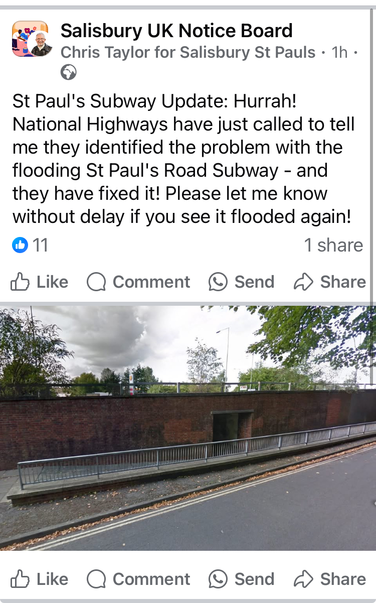
    A recent “Berlin Wall” example that we had back in February was Manningtree Station.  The Secretary of State has accepted that a decision to allow this wall to stay in place was flawed, but 3 months on, there’s no sign of anything changing. 

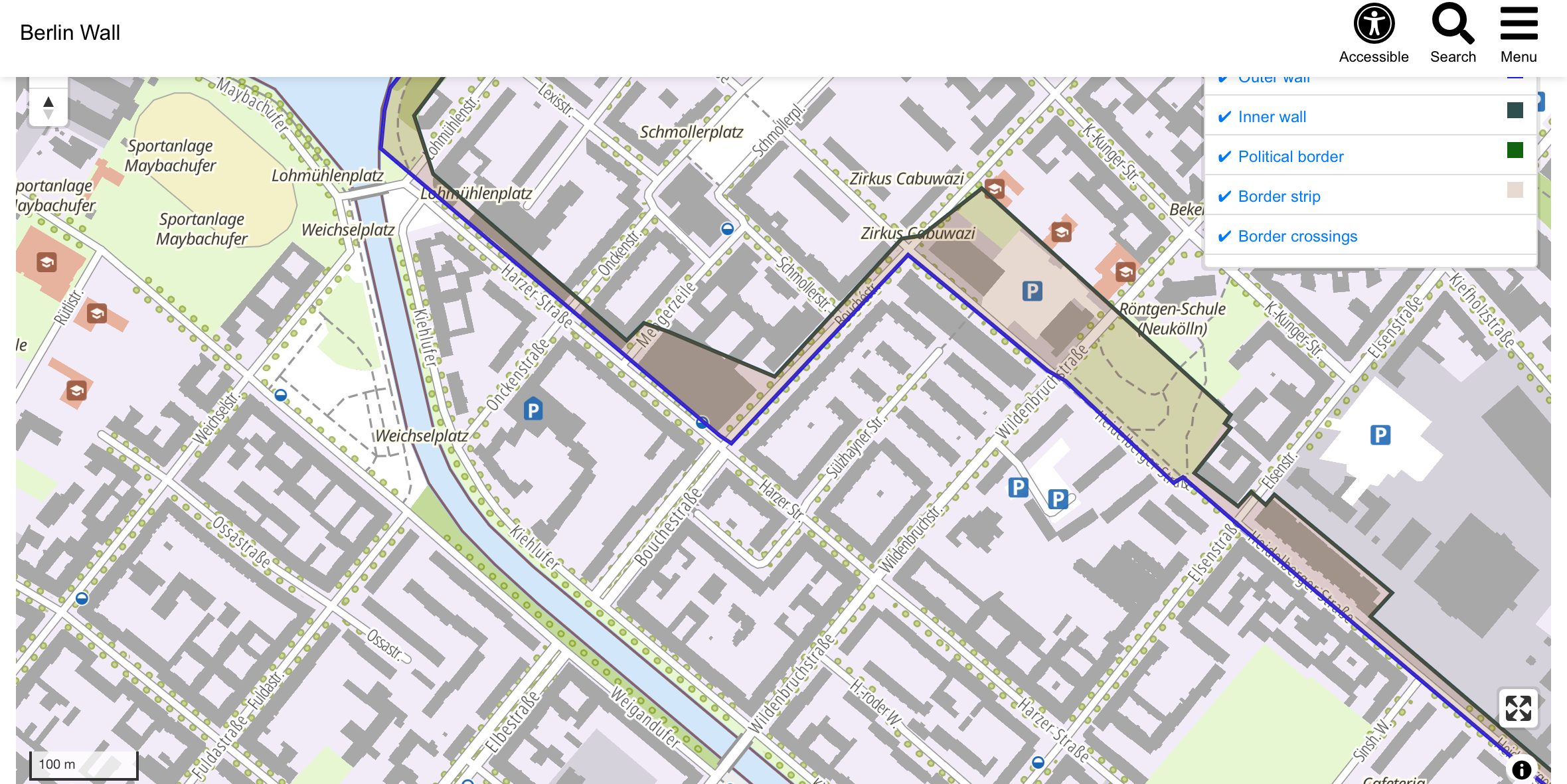
    Drivers of course like using this sort of imagery and reference as well. I’ll put up a few pictures of the actual Berlin Wall in the replies – not the familiar Brandenburg Gate, but some of the suburbs where ordinary lives are lived. Don’t forget that the Wall went all around Berlin, e.g. almost to Potsdam in the west, spanning fields, forest, rivers, railways and lakes. 

    You had the enclosing main wall that west Berliners faced, behind this the so-called Death Strip cleared of buildings that could provide escapers cover, clear for motorised patrols, watchtowers, all with the armed patrols of the border police, and then an inner wall. 

    Here’s a map.  I don’t think it’s searchable. https://www.berlin.de/mauer/en/route/the-wall-inside-the-city/

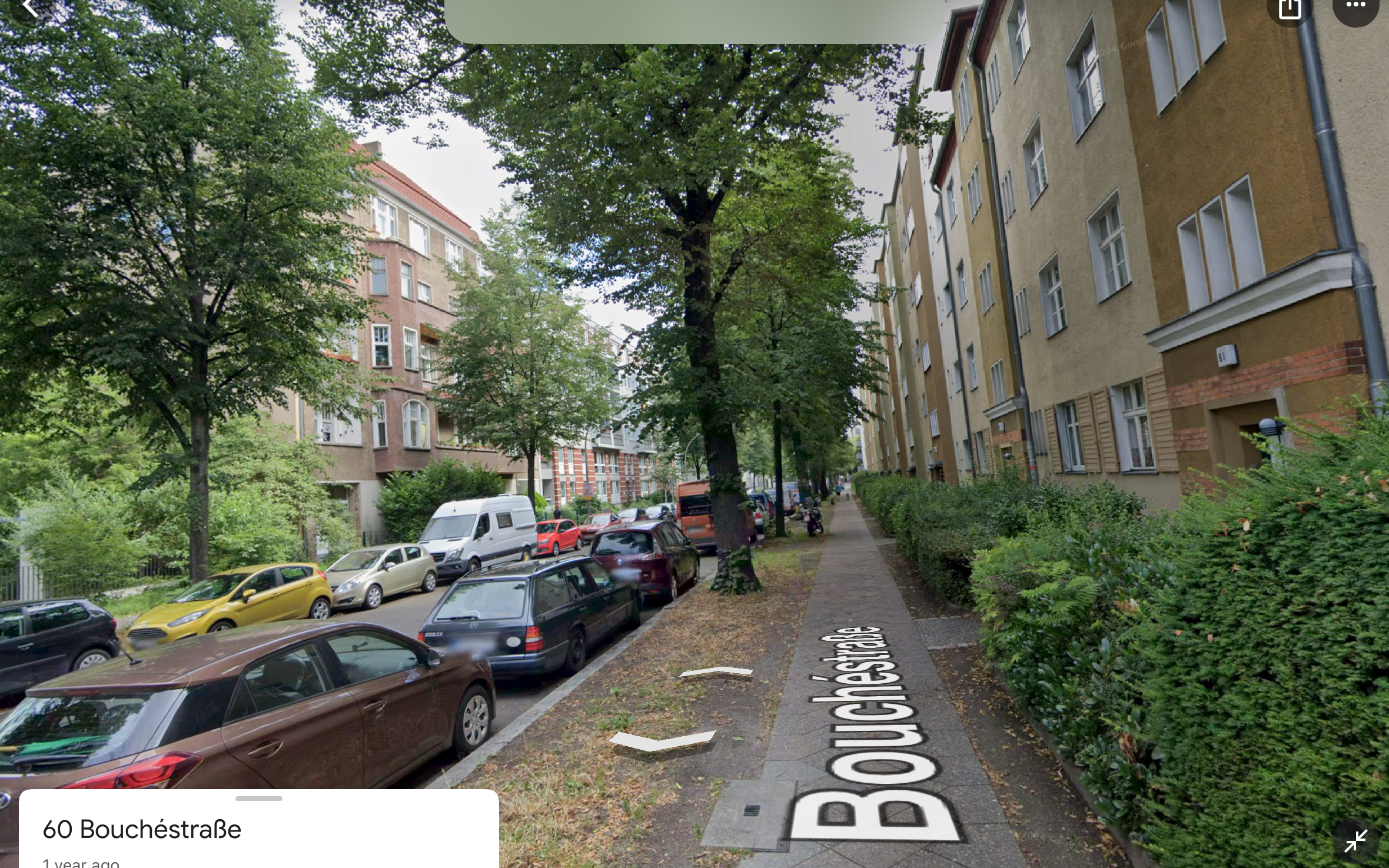
    Coming up as I say are two suburban streets photographed in the 1980s from the western side of the wall.  Plus some others I found online for which I don’t have locations. 

    Then let’s come back to the UK, and what’s this, drivers? Why it’s a little residential road, partially demolished and severed in two, another road cut intwo with an enormous bridge over it for pedestrians to pick their way along. 

Viewing 15 replies - 1 through 15 (of 29 total)
  • Author
    Replies
  • #1153915
    0
    chrisonabike

    I’m sure they do, but they’re
    I’m sure they do, but they’re probably a bit more prepared…

    Meanwhile, they troll UK civil engineers with stuff like this *:

    A new cycling underpass in Utrecht

    … and this:

    Submerged Bicycle Bridge in Haarlem

    * … but mostly just by having guiding principles which don’t bend everything else too far out of shape to accommodate mass motoring.

    #1153913
    0
    David9694

    I bet the Dutch underpasses

    I bet the Dutch underpasses don’t flood. 

    https://cdn.road.cc/wp-content/uploads/roadcc/IMG_7467_0.jpeg

    #1153893
    0
    David9694

    Sometimes I forget that I’m a

    Sometimes I forget that I’m a [checks notes] bike-head who wants to impose my views on all of us.  

    I can’t generate a link to the regional ITV story of the family further of the A36 trying to cross it on foot – and giving up.  A spokesman for drivers said “don’t live near a main road, then” (probably).

    https://cdn.road.cc/wp-content/uploads/roadcc/IMG_6542.jpeg

    #1153889
    0
    chrisonabike

    Here’s Den Bosch (with

    Here’s Den Bosch (with kilometer scale) – I count 22 crossings (in yellow) and I’ve probably missed some.  Note at least 3 are actually on minor roads.  One of those looks like a major road (the N617 to the South-east) – but it looks like this was expanded from a minor road and the old road kept so that the vast majority of the traffic will be separate from cyclists on the “main” part.

    https://cdn.road.cc/wp-content/uploads/roadcc/denbosch_0.png

    #1153887
    0
    chrisonabike

    Meanwhile, here’s how they

    Meanwhile, here’s how they deal with barriers in NL:

    Canal (when it was restored): https://www.aviewfromthecyclepath.com/2015/01/of-six-new-bridges-in-assen-three-are.html

    Can’t find it now but that blog or BicycleDutch covered all the cycle route crossings of a ring road in a Dutch city (all grade-separated).  Looking at Groningen and S’Hertogenbosch this is the case – I think the biggest “gaps” are about 500 meters but where there are big residential areas on either side it is more like 200 meters or less.  (And the crossings are much friendlier than the UK “dive into the dank pit” or “concrete trench in the sky” approaches we normally take!).

    Same goes for the railway in Groningen (there is a “missing link” across the railway in Den Bosch that BicycleDutch has posted on).

    But of course they’re far more sophisticated than e.g. here – they usually think in terms of separate networks for different modes (and no – that doesn’t just mean “fit the active travel in round the cars, where we can…”): https://www.aviewfromthecyclepath.com/2012/07/unravelling-of-modes.html

    #1153885
    0
    David9694

    Next up, I’ve added some

    Next up, I’ve added some arrows to show the north-south (where I think the problem is worst)  and then east-west crossing points from a cycling and pedestrian point of view.

    If we start at the western end:

    1. Scary roundabout for cyclists or iffy underpasses for peds (red arrow)

    2. Blue arrow – no pavements for this road underpass – doable by bike

    3. There is a narrow path following the river for cyclists and peds 

    4. As 1 above

    5.  high over bridge leading to older flat bridge over the railway cutting 

    6. Wordsworth Road was severed by the Churchill Way, so another ramped bridge instead

    7. As 1 above; this is also the start of a driver rat-run to cut off this section of the ring road and the often slow Southampton Road. I’d mind the ring road slightly less if it actually worked!

    8. underpass (yellow arrow); the road running alongside the Churchill Way also gets used as a rat run to avoid delays on the College roundabout 

    9. Milford Street (pink arrow) – a normal road; before that, Winchester Street (underpass) and then after (red arrow), St Anne Street, both severed; (perhaps its a bonus that as such they don’t carry through motor traffic any more) 

    10 lastly, Exeter Street with its underpasses, not sure what the thinking here is for cyclists at spots like this.


    https://cdn.road.cc/wp-content/uploads/roadcc/IMG_6537.jpeg

    #1153883
    0
    David9694

    Having told off Brits for

    Having told off Brits for making the Berlin Wall comparison, Salisbury has its own wall that has many of the same traits – built around the same time, the threat of death or injury if you don’t use a limited number of crossing points and most of said crossing points are themselves a bit of a subterranean gauntlet. 

    Firstly, here it is blended onto an older map of the city, showing how porous it was before. 

    https://maps.nls.uk/geo/explore/#zoom=16.8&lat=51.07053&lon=-1.80370&layers=193&b=osm&o=64

    https://cdn.road.cc/wp-content/uploads/roadcc/IMG_6539.jpeg

    #1153877
    0
    David9694
    chrisonabike wrote:
    OTOH perhaps most people in the UK have a blind spot?  Just across the water to the west, you can still find literal walls dividing disputed areas in Britain

    More here on these, with pictures.

    And those can be likened to the Berlin Wall. 

    #1153859
    0
    David9694

    As you poke around on the map

    As you poke around on the map and zoom in, there are these little blue/white circles dotted about. Water pumps, it turns out. Kein Trinkwasser. 

    Edithttps://www.travelgumbo.com/berlin-s-historic-water-pumps/

    https://cdn.road.cc/wp-content/uploads/roadcc/IMG_7458.jpeg

    #1153873
    0
    David9694
    hawkinspeter wrote:
    David9694 wrote:
    As you poke around on the map and zoom in, there are these little blue/white circles dotted about. Water pumps, it turns out. Kein Trinkwasser. 

    Those look great – why can’t we have them along our roads here?

    Maybe there’s some houses that still don’t have a main supply or something? To answer your question : because we’d vandalise them.  I remember arriving in Switzerland on my inter-railing trip in about 1990 – I didn’t believe the woman in the tourist office when she said to buy a tram ticket from a machine on the street.

    Talking of things we don’t have:

    https://cdn.road.cc/wp-content/uploads/roadcc/IMG_6526.jpeg

    #1153875
    0
    David9694

    We’ve a Passport to Pimlico

    We’ve a Passport to Pimlico history of them here too when you dig into it.

    https://wikishire.co.uk/map/#/base=colour_detached/centre=51.485,-0.964/zoom=12
     

    #1153871
    0
    David9694

    I guess the photo is taken

    I guess the photo is taken from the crossroads with Harzerstaße, looking north-east along Boucherstrße over the border strip inside the outer wall as it turns the corner. 

    https://cdn.road.cc/wp-content/uploads/roadcc/IMG_6524.jpeg

    #1153869
    0
    chrisonabike

    OTOH perhaps most people in

    OTOH perhaps most people in the UK have a blind spot?  Just across the water to the west, you can still find literal walls dividing disputed areas in Britain

    More here on these, with pictures.

    #1153865
    0
    chrisonabike

    David9694 wrote:

    David9694 wrote:
    It seems extraordinary now how municipal boundaries (tedious to 99.9% of people) were adopted militarily and as a way to settle the biggest conflict ever to affect Europe.

    Long history of that I think… check out the Belgian-Dutch border for some extreme examples of this (including a Dutch enclaves within Belgian enclaves).  And of course Kaliningrad.

    #1153867
    0
    David9694

    The doorway in the old photo

    The doorway in the old photo is no 58, so behind where we are now – this position affords the best modern day view.  

    https://maps.app.goo.gl/9ATji6LVwPEt55h39

    https://cdn.road.cc/wp-content/uploads/roadcc/IMG_6523.jpeg

Viewing 15 replies - 1 through 15 (of 29 total)
  • You must be logged in to reply to this topic.