Bike Climb website

  • Creator
    Topic
  • #32975
    JLasTSR

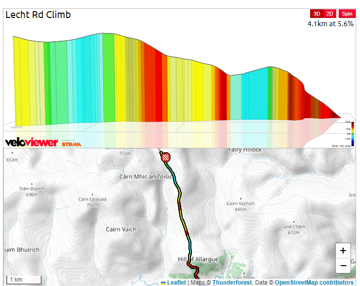
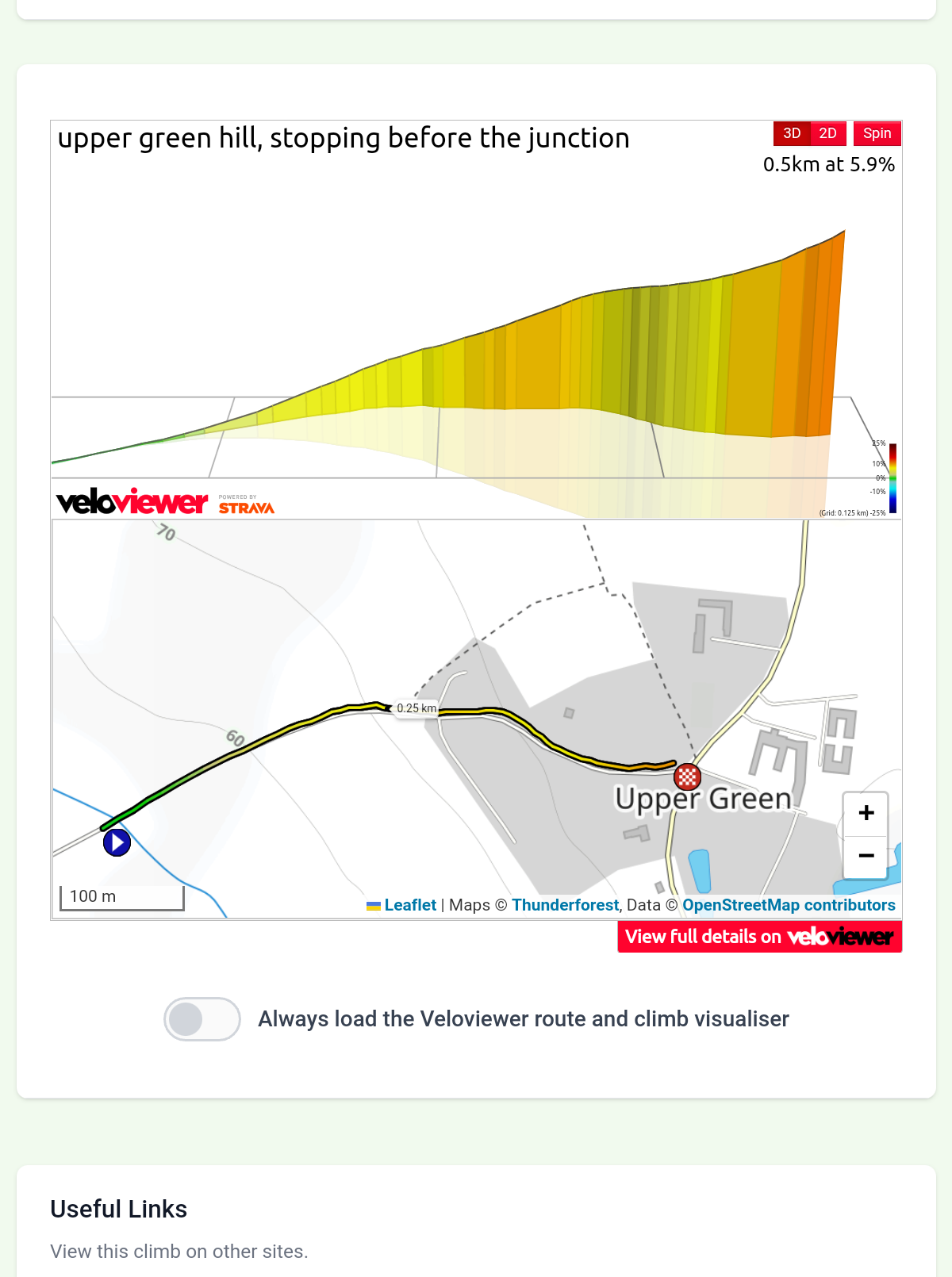
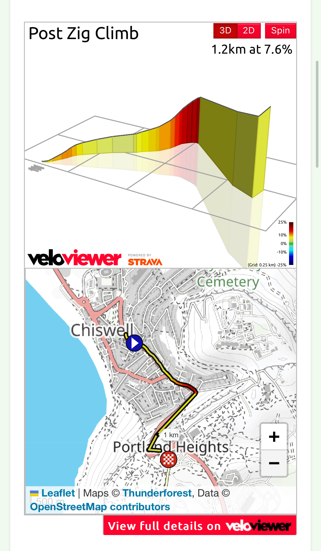
    I am sure lots know about this website but I find it useful when planning some of my.longer rides. I admit I like to know how much I am going to suffer.

    https://bikeclimbs.com/climb/united-kingdom

Viewing 9 replies - 1 through 9 (of 9 total)
  • Author
    Replies
  • #1024217
    0
    S.E.

    It’s certainly useful with

    It’s certainly useful with these (veloviewer) gradients and stats… I’m not into Strava either, no bike computer, Google maps offer a profile picture and total elevation/descent for personal itineraries, but with much less details, so this comes handy, provided the climb is listed, of course.

    Also I didn’t know that I had climbed several 1st category recently, and even HC (beyond categorization) mountain passes! I’m bragging, I’m not into performance, 10 kg bike, in my fifties, I really struggle over a few %, so I was surprised to learn that thanks to this website!

    #1024215
    0
    mdavidford

    I always struggled a bit with

    I always struggled a bit with this one.

    https://road.cc/wp-content/uploads/roadcc/rainbow road 64.jpg

    #1024213
    0
    andystow

    I definitely walked bits of

    I definitely walked bits of this on my LEJoG.

    https://bikeclimbs.com/climb/united-kingdom/scotland/aberdeenshire/cock-bridge/lecht-rd-climb


    https://cdn.road.cc/wp-content/uploads/roadcc/lecht.png

    #1024211
    0
    JLasTSR

    That one of yours looks too

    That one of yours looks too much for me, this one took me by surprise and it was only a tiny climb on the way to a lunch I had looked at it and thought that’s too short to worry about. However I was wrong the last little bit with my bottom gear was a bit will I, won’t I. I had also given blood two days before which probably didn’t help. 

    https://cdn.road.cc/wp-content/uploads/roadcc/screenshot1729838228318-1466784143.png

    #1024209
    0
    mark1a

    Looks like all the data is

    Looks like all the data is pulled from Strava, and the visuals are taken from VeloViewer (a great product/service, which in turn also gets its data from Strava).

    Here’s one of my local “favourites” ? unfortunately living at sea level in Dorset means it doesn’t matter what direction I ride in, there’s a climb to be had…


    https://cdn.road.cc/wp-content/uploads/roadcc/IMG_1592.jpeg

    #1024207
    0
    JLasTSR

    Never seen veloviewer and
    Never seen veloviewer and having just looked at it, I’m struggling it doesn’t have a map for me to see the climbs although it obviously has the data somewhere but I cannot understand how to use it to get to what I want, namely the data on climbs on the route I am plotting sorry.

    #1024205
    0
    davebrads

    It’s just a list of climbs,

    It’s just a list of climbs, the top ones all appear to be gravel. Clicking on a climb brings up a link to the Veloviewer page and some stats that appear to have come from the same source. Why do we need it? Just go straight to Veloviewer.

    #1024203
    0
    JLasTSR

    Living in Suffolk anything
    Living in Suffolk anything not flat is a serious hill!

    A few years ago this site did not appear to have a tie up with Strava, it does seem it is converging more with Strava at the moment. Since I don’t use Strava it is probably more useful for me than for others as it gives me access to climb data that others get though Strava.

    #1024201
    0
    S.E.

    Climbing categories look a

    Climbing categories look a bit “inflated”, though, at least for the climbs I know in my area, on the continent…

Viewing 9 replies - 1 through 9 (of 9 total)
  • You must be logged in to reply to this topic.