- News
- Reviews
- Bikes
- Accessories
- Accessories - misc
- Computer mounts
- Bags
- Bar ends
- Bike bags & cases
- Bottle cages
- Bottles
- Cameras
- Car racks
- Child seats
- Computers
- Glasses
- GPS units
- Helmets
- Lights - front
- Lights - rear
- Lights - sets
- Locks
- Mirrors
- Mudguards
- Racks
- Pumps & CO2 inflators
- Puncture kits
- Reflectives
- Smart watches
- Stands and racks
- Trailers
- Clothing
- Components
- Bar tape & grips
- Bottom brackets
- Brake & gear cables
- Brake & STI levers
- Brake pads & spares
- Brakes
- Cassettes & freewheels
- Chains
- Chainsets & chainrings
- Derailleurs - front
- Derailleurs - rear
- Forks
- Gear levers & shifters
- Groupsets
- Handlebars & extensions
- Headsets
- Hubs
- Inner tubes
- Pedals
- Quick releases & skewers
- Saddles
- Seatposts
- Stems
- Wheels
- Tyres
- Health, fitness and nutrition
- Tools and workshop
- Miscellaneous
- Buyers Guides
- Features
- Forum
- Recommends
- Podcast
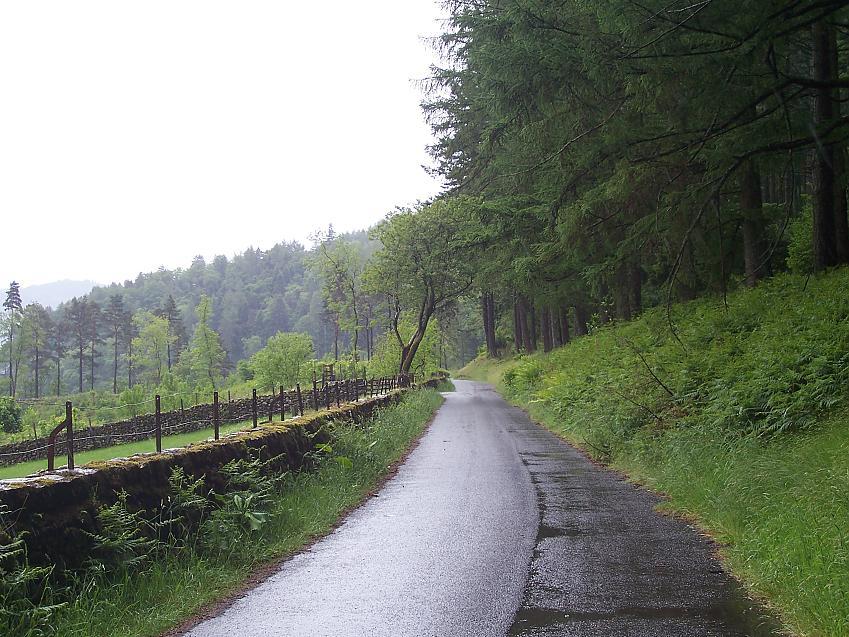
 Quiet road on western shore of Thirlmere. Image by Cathredfern (CC BY-NC 2.0)
"One of the only safe road cycling routes": Cyclists object to complete closure of "key part" of National Cycling Network
Cycling UK has spoken out about a proposed "complete closure" of a Lake District road due to storm damage from two years ago, a council plan which, the charity and campaign group says, would "block off a key part of the National Cycle Network" and force cyclists to use "a narrow section of busy A-road, hemmed in by walls with fast traffic and HGVs".
The road, part of NCN route six along the western shore of Thirlmere reservoir, is "one of the only safe road cycling routes leading towards Keswick", Cycling UK says, but has been temporarily closed for two years due to damage suffered during Storm Arwen and now faces being shut permanently.
Cumberland Council has proposed a Traffic Regulation Order (TRO) to close the road to all traffic, including cyclists and pedestrians, with a consultation running until 15 September on the plan to leave "two dead-end roads with no through route and no safe alternative".
The road was first closed in the aftermath of the 'Beast from the East' in 2018 while contractors worked to repair damage caused by uprooted trees. In November 2021, Storm Arwen felled 1,500 more trees and prompted another temporary closure due to disturbed rocks on the crags above and trees blocking the road.
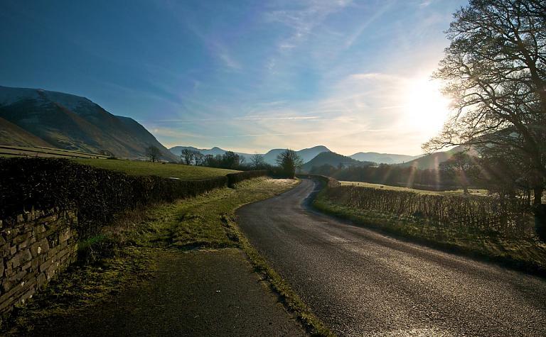
[Thirlmere western road, image by Heliosphere / CC BY-NC-ND 2.0]
While temporary closures usually do not exceed 18 months, a Freedom of Information request (FOI) showed that the council does not have a predicted repair or reopening date, with "further assessments" scheduled to "gather more information relating to the condition of the hazardous area".
Cycling UK stresses that it acknowledges the importance of public safety, with falling rocks an "obvious hazard", however "there are plenty of roads around the country where falling rocks remain a risk without resulting in the extreme solution of permanent closure".
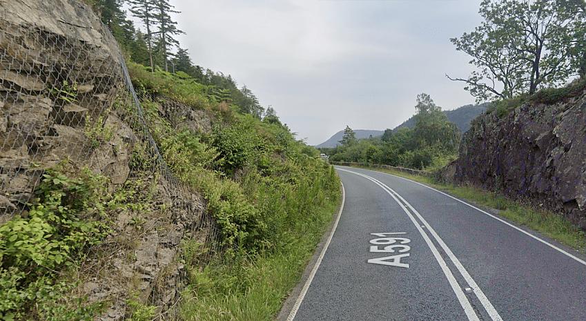
"There are a variety of mitigating steps in different places, such as fencing or netting — in fact, netting is already used to prevent rock falls on the A591 on the opposite shore," Cycling UK says. "So why haven't these solutions been considered to reopen the route here? Instead, the council is opting to close one of the most enjoyable and atmospheric cycling routes in the Lake District.
"Crucially, any risk assessment seems to have been focused solely on the risk of falling rocks on this road, without looking at the bigger picture of cycle safety. Closing this route forces cyclists onto a busy, and arguably much less safe, A-road up the eastern bank of the reservoir."
[The alternative route along the A591]
An FOI request asking for copies of the risk assessment for the closure and diversion route resulted in the admission that the council's diversion route "only stipulates suitability for vehicular traffic; therefore no diversion route is provided for pedestrians and cyclists at this time".
Cycling UK called this "ridiculous", adding: "Any assessment of the benefits and risks of closure on the grounds of safety clearly needs to look at the bigger picture and what is likely to result from this route being closed, not just the risk of keeping it open.
"We think it's more than just a local issue: it has a much wider impact. The closure shifts cyclists, horse riders and walkers from a safe, quiet road, to a busy, unsafe A-road, without any comparative safety audit. That disregards the Traffic Regulation Act criteria for making an order, and is a flawed decision-making process.
"This section of National Cycle Network route 6 is important for local people living around Keswick, and it's also a popular area for people visiting from further afield, so has wider relevance. Perhaps you have even had the pleasure of cycling it yourself at some point.
"It is also significant that this is within a National Park. All public bodies and utility companies have a statutory duty to have regard to National Park purposes: namely to conserve and enhance their natural beauty, wildlife and cultural heritage, and to promote opportunities for the understanding and enjoyment of their special qualities by the public. Closing this road goes against those duties, which is why we think it's important to resist it."
Cycling UK has called on supporters to email Cumberland Council before the consultation closes next week (15 September) and have drawn up a template objection listing the objections.
Dan is the road.cc news editor and has spent the past four years writing stories and features, as well as (hopefully) keeping you entertained on the live blog. Having previously written about nearly every other sport under the sun for the Express, and the weird and wonderful world of non-league football for the Non-League Paper, Dan joined road.cc in 2020. Come the weekend you'll find him labouring up a hill, probably with a mouth full of jelly babies, or making a bonk-induced trip to a south of England petrol station... in search of more jelly babies.
Latest Comments
- cyclisto 2 sec ago
My bicycle is well now in it's second decade and the plan is to go with it as much as possible. It is though quite versatile, and I am always open...
- Miller 4 min 55 sec ago
> One cool thing is that both mechs use the same battery (take note, Campag) ...
- giff77 5 min 39 sec ago
At least in the Netherlands parking your bike at the train station appears to be plentiful and requires a ticket to gain access. Compare that to...
- Griff500 42 min 49 sec ago
Are you saying the figures in the article are wrong (DA 2507g; Red 2496g) or are you arithmetically challenged?
- andystow 44 min 19 sec ago
There's a good Youtube channel of a London-based cyclist who uses one, and I think sells them. It's been over a year since any new videos, though.
- hawkinspeter 49 min 37 sec ago
Yeah - I was meaning blocked by the green-light flow of traffic.
- andystow 52 min 23 sec ago
I've never found a bus system that didn't have a learning curve. I've ridden buses in at least:...
- chrisonabike 1 hour 19 min ago
Agreed - I was just going on ones which IIRC were mentioned incidentally as supporters e.g. I think I read RNIB (who certainly were against these...
- jaymack 2 hours 29 min ago
Did you pay on a credit card? If you did you may be able to take advantage of s. 75 refund


Add new comment
15 comments
The route does need to be brought back - the A591 past Thirlmere can be bloody awful if the road is busy...which is basically all the time during daylight hours. It's not good when the road is quiet either as you get cars absolutely steaming down - on the winding sections they are not expecting to see you.
As a temporary (although not ideal) solution, why can't they simply allow cyclists to use the permissive path along the East side - it's a wide fine gravel road that is plenty wide enough for walkers and other users, it connects to the existing open part of the bridleway and finishes at swirls car park just at the end of Thirlmere...I "might" have used this at low light in the past to avoid the local F1 drivers and don't see why this can't be used as a stopgap...it's on land managed by UU anyway.
How good is the permissive path?
Can it up upgraded to a 3m metalled surface and made into a Public Bridleway by United Utilities?
"Can it up upgraded to a 3m metalled surface"
Already a fine gravel path which I assume is used as a road for heavy equipment and/or rangers. The path is very wide (including two bridges which are at-least 3m wide), very well kept and ready-to-go from what I can see.
Image attached is the current surface - it's the same throughout. Not my image, taken from a walking forum
This 'used' to be a popular route of mine, at least until early 2018 when the 1st closure happened. United Utilites were trying to get that road closed permanently prior to 2018 and it is worth noting, the danger from the crags is in dispute.
Thousands certainly still choose to risk bypassing that fence, inadequate signage part to blame. Hobsons Choice of course comes into play too.
And what is depressing is how subservient the council are or seem to be, to the whole situation.
Have they not heard of tourism? It is certainly a tourist black spot.
Is it me? or can nobody else see the perfect solution close the road to all motor vehicles! The vibrations of hgv's along that road probably add to the problem of land slippage. As somebody else said I'd rather risk a falling rock than a _ock in a car!
It's also mathematically proven that the A591 is not a great place to cycle. When drivers here are not enjoying speed and acceleration, they're either struggling to corner or staring at the scenery instead of the road.
https://www.express.co.uk/life-style/cars/572195/A591-mathematically-Bri...
This was before the 40mph limit was brought in, but the distracted driver argument still stands!
It quite shocking that they are considering abandoning this route. Especially as they've only recently invested in upgrading a bridleway to a surfaced cycle route to link up with the west shore road (although it's still a work in progress, how you are supposed to get on the southbound carriageway from that path is a mystery).
https://goo.gl/maps/pSx2s3aSpw8A1cGo9
https://www.lakedistrict.gov.uk/caringfor/localcommunities/northern-lake...
I am familiar with both from regular holidays in the Lakes. The western side of Thirlmere was one of our favourite rides, either from Legburthwaite or Dunmail Raise. The A591 beside Thirlmere isn't a nice road to drive, never mind cycle. I've objected as suggested by Cycling UK as it does break up the cycle route, unless they create a new segregated route on the eastern side.
Not familiar with the route so my comment is on the principle. But it seems typical of the institutional bias against active travel. The risk assessment focuses on vehicles only and compares one route with risk of rock fall against another with none. In these terms a no brainier. However pedestrian or cycle risk of rock fall (which can be mitigated) against a risk from traffic on dangerous road for active travel not even considered.
Aye, we've a long way to go in this country.
The section of the A591 along the reservoir looks marginally worse than the section from the southern end down to Grasmere which cyclists have always had to take to go south from Thirlmere. The stretch to Grasmere has a 60mph limit whereas along the res it's a 40mph limit due to the winding nature of the road so that makes it less daunting. Perhaps, as a mitigating measure the council could reduce the limit even further to 30mph if the proposed permanent closure goes ahead. I notice that the stretch of road they are proposing to close to all vehicles is very short - a few hundred metres at most? According to the O.S. map there is a footpath at that point too. Is that also being closed off or could that be a possible way round the closure for "adventurous" cyclists?
That said, I agree that United Utilities shouldn't be allowed to get away with taking no action as it's their responsibility to keep the road safe and open. At first I thought it was the council penny-pinching (which is understandable in these cash-strapped times) but having read all the info it's a private company dragging their feet and they should be made to cough up.
Heretic! How can you expect the company to waste money on cyclists and pedestrians when they have shareholders to feed?
This is just like lots of other things that the tories sold off for short term gain e.g. water: standards fall, profits go up, lack of investment, rules ignored, and prices rise to pay the dividends.
No, it's far longer than that - it's effectively the full length of Thirlmere, which is what you would need to do on the A591 as an alternative. At the start of summer a group of us from a local cycling club decided to ignore the road closed signs, bypassed the 3m high fences, scrambled through the fallen trees etc - quite an adventure! We were gutted that they were planning to close it permanently so a lot of us have signed the petition and sent objections to the council. I'd urge anyone who knows and has enjoyed this route in the past to do so as well. It just smacks of finding excuses to do nothing (or the bare minimum) rather than invest in making the road fit for purpose.
EDIT - Yes, I see what you mean, having looked at the TRO more closely - the Red area is quite small, but it effectively cuts off the road as a through route, so it might as well be the whole road.
I'd take my chances wth the risk of falling rocks rather than dodgy drivers on a fast narrow road any day!
Wear a helmet!