

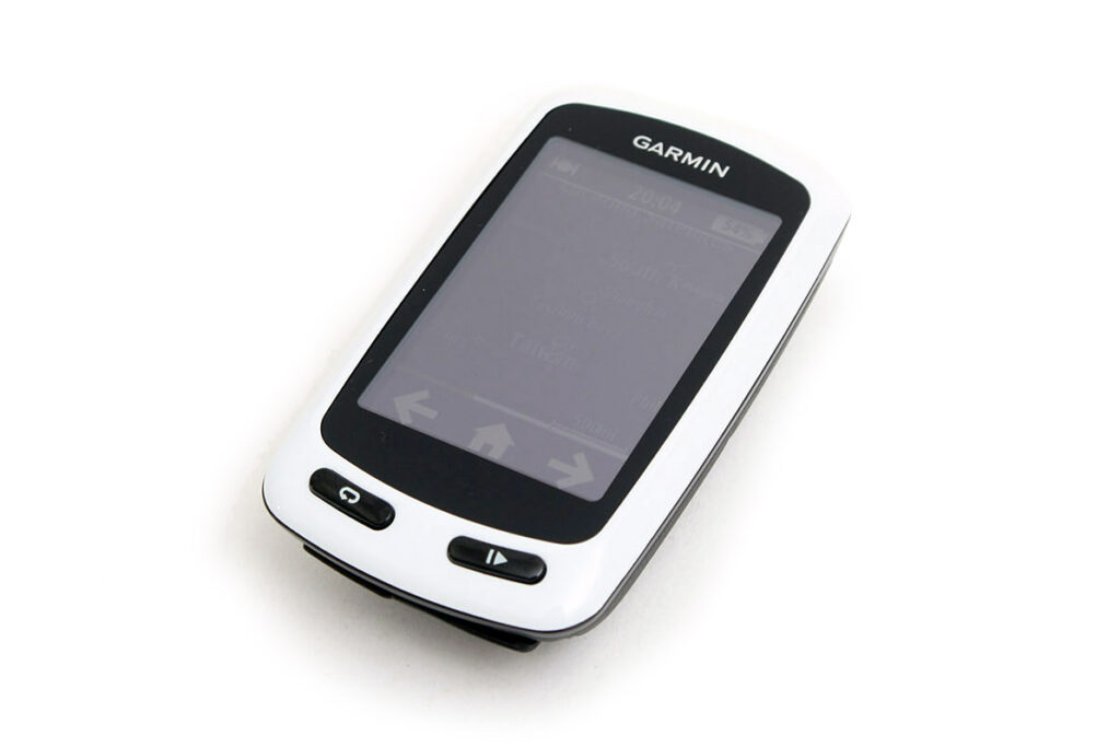
Garmin recently released two new computers into their Edge GPS range: the Touring (£199.99) and the Touring Plus (£249.99). We’ve had the Edge Touring in on test for a couple of weeks now but we’re a way off a full review, so in the meantime we thought we’d give you a quick look at what’s on offer here.
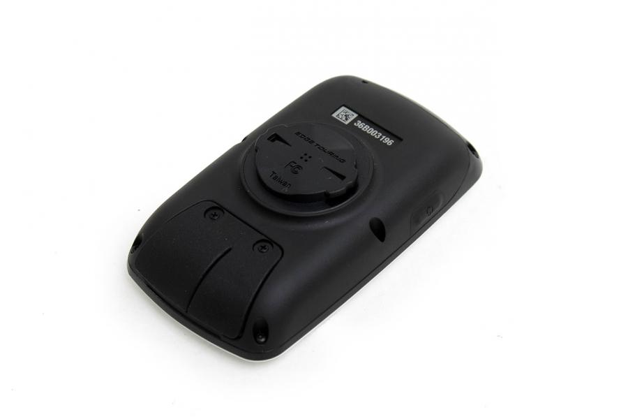
Both the Edge Touring and the Edge Touring Plus are based on the Edge 810 that Garmin launched a few months ago. They have the same waterproof housing (5.1 x 9.3 x 6.6cm), display size (3.6 x 5.5cm) and resolution (160 x 240 pixels, touchscreen), the same rechargeable lithium-ion battery with a claimed runtime of up to 17 hours, the same buttons, the same quarter-turn mount system… They’re a different colour, mind. The 810 is black whereas the Touring models are both white. Well, the upper sections are white.
Garmin bill up the Edge Touring as “the sat nav for your bike”. Isn’t the 810 a sat nav for your bike, then? Well, it is, but it’s equally a training tool. The Edge Touring, as the name suggests, is aimed at tourers, plus Audax riders and leisure cyclists… people for whom the training aspect is less important.
The Edge Touring still measures a whole load of different aspects of your ride, but you don’t get the option of displaying your cadence (pedal revolutions per minute) or power, for example, setting up interval training sessions or racing against a virtual opponent because that’s not what this computer is all about. You don't get Garmin's live tracking features either, allowing other people to follow you online.
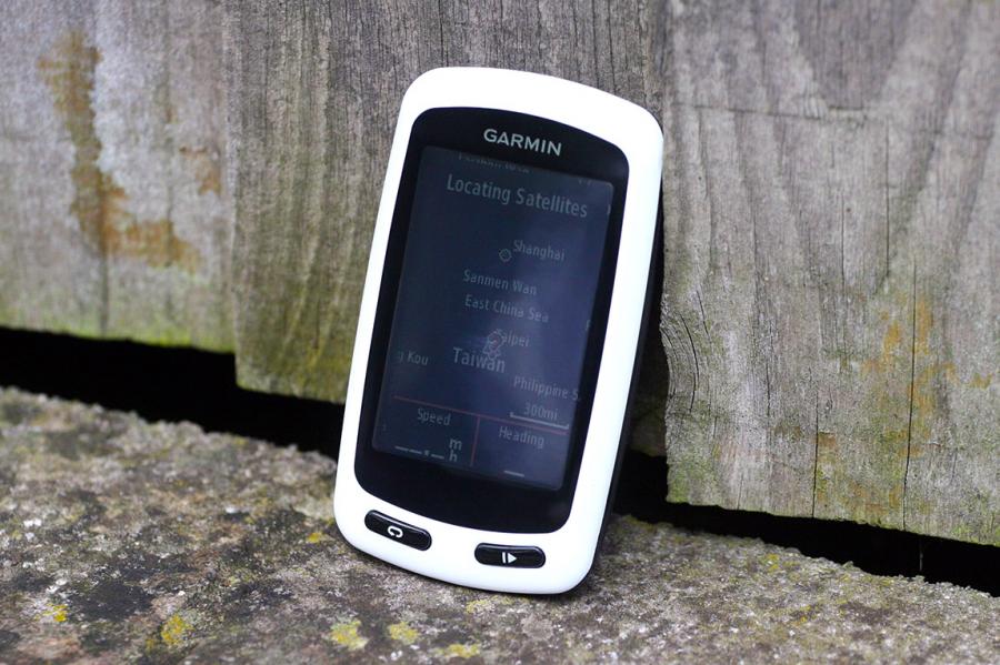
No, the Edge Touring concentrates on navigation and it comes with a preloaded Garmin Cycle Map of Europe and the ability to add further maps via microSD data cards. Like a sat nav for the car, the Edge Touring allows you to enter an address and it’ll give you turn-by-turn directions to get you there.
There are three different modes to choose between: cycling, tour cycling, and mountain biking. As that suggests, the mapping includes unpaved roads, paths and trails so it will come up with off-road routes too, if you want them.
One other interesting navigational feature is the RoundTrip routing. Say you have time for a ride of about 50 miles: you tap that distance into the Edge Touring and it’ll come back to you with up to three suggested routes with the same start/finish point, along with a route elevation profile for each. The Edge Touring also includes points of interest specifically for cyclists: sights to see, places to eat and stay, for example.
As with the other Edge models, you can use the Edge Touring with the Garmin Connect website. You can upload and save all your rides here, plan new rides and download them to the unit. You can also use it with the Garmin Adventures website where you can share your ride stories and swap routes with other people. Oh, and you can use it with Strava and other websites of that kind too.
As mentioned, the Edge Touring Plus is more expensive at £249.99. What do you get for the extra 50 quid? The Edge Touring can’t give your heart rate, while the Touring Plus is compatible with an ANT+ heart rate monitor (although the £249.99 package doesn’t include the HRM).
The Touring Plus also has the addition of a barometric altimeter so it can give you detailed information on elevation. You can get your total ascent and descent over the course of your ride, for instance, and the gradient of the road you’re riding. Those are the biggest differences.
Ah, nearly forgot… One other thing that's worth considering if you're touring in the back of beyond and you don't have access to a mains power supply every day is that Garmin do an external power pack (£69.99). They reckon it'll supply an extra 20hrs of runtime to an Edge 800. You can recharge the external power pack from the mains, from a USB charger, or via its fold-out solar panel.
Go to the Garmin website for details on the entire Edge range. We'll have our review on road.cc soon.


32 thoughts on “Just In: Garmin Edge Touring”
let me know if you want a
let me know if you want a second opinion 🙂 …. i will give it back eventually
Or you could just use and
Or you could just use and Etrex 20 or 30 (latter has Ant+ for HRM, cadence) – they don’t have the more usual cyclocomputer functions that this probably has, but they take AA cells (a spare set of eneloops are way cheaper than an external battery), and are about £130 and £170 respectively, without mapping.
If this tiny computer is
If this tiny computer is capable of creating its own loops, and differentiating between on-road and off, why can’t the Garmin course-builder do the same on-line?
Every time I create a course in a new area, it finds me at least one MTB trail if I choose not to head down A roads, and you won’t know this ’til you get there.
double post
double post
nowasps wrote:Every time I
On Garmin Connect there is a ‘Stay on Roads’ tick box, is that ticked? On the rest of the route planning sites you can normally choose a route optimised for Driving, Cycling or Walking – if you choose Driving that should stop the routing engine using bridleways and make it just use roads.
I use the stay on roads
I use the stay on roads option, but use the cycling rather than driving option. If you don’t, you have to plot the course with very great care to stay off the busiest roads.
Just wondering why not have the on and off-road distinction available at website level?
If the performance of all of
If the performance of all of the Garmin 500s and 800s in my cycling club is anything to go by then I can’t think of a device I would trust less to guide me through the back of beyond than an Edge Touring.
Garmin still don’t seem to have got the hang of the basics of building a device that can follow a pre loaded route on main roads. No matter what website you build the route on it still only seems to work some of the time and even when it does work the turn alerts frequently come after the turn. I often have to resort to just following the map, but that really spoils a ride.
I fail to understand how they continue to get the basics so wrong when TomTom, Google, NavTec, Nokia, etc. all manage to make it work.
Garmin’s forum suggest there are many others who suffer similarly. I’ll be very interested to read how the Edge Touring works for you.
(Also, the barometric altitude readings don’t work that well due to weather pressure changes, again, I’ll be interested to see how you find those. There is frequently a 25% difference between my Garmin 800s cumulative elevation and that recorded by Strava on my phone).
tom_w wrote:
Garmin still
I could not disagree more, myself and my riding buddies use an 800 for virtually every ride, it always takes us down the route we planed everytime, here are my tips for success.
Don’t plan a route on anything other than Garmin BaseCamp, using MapMyRide etc. doesn’t work as the planning algorithms are different, remember that the Garmin will plot its best route between Way Points and therefore it can plan a different route.
Learn how to use BaseCamp, its totally horrible user interface is hard to figure out, so watch the videos of frustration (come on Garmin change the damn interface to work like all other mapping software).
Add lots of Way Points, I add them just after each junction that I want to turn off, don’t assume that it will take the same left/right, force it by putting a Way Point.
Ensure your Activity Profiles are the same on BaseCamp and the Garmin device, this confused the hell out of me, its the Routing Options within the Activity Profiles you need to check are the same, one issue I had is it would never take me on a main road even when I wanted to, this was because the Routing Options had Highways turned off by default for Bicycle.
Following these rules meant the Garmin worked perfectly.
mikeprytherch
Cheers Mike, I’ll definitely give that a go. Does that method mean the turn directions come a reasonable distance before the turns too?
It absolutely should not be that difficult though, the Garmin Connect website (which admittedly I no longer use) should do all of what you describe automatically, otherwise what’s the point of it?
People want to easily create routes, share them and follow them, Garmin really need to put some work into making that possible.
tom_w wrote:mikeprytherch
I’ve not seen any setting with regards to the timing of the instructions, but mine appear with loads of time, normally at least 100 yards from the junction.
tom_w wrote:There is
So why aren’t you complaining about the shoddy GPS altimeter in your phone?
Round trip routing sounds
Round trip routing sounds pretty cool for all cyclists. It would be fun to put in that I have 90 minutes for a ride at 18mph and it spit back some suggested courses
I don’t pretend to understand
I don’t pretend to understand half of that but I have used Garmins for 15 years now and they always warn you in plenty of time if you do way points properly . Every turn gets a Wp just after it, say 50 metres. Then the GPs knows which way you are going. Stick a Wp on the junction and you don’t know until you have rolled up to the white line. This method also give you time for a audible warning and time to react to it.
Re this device, I would have thought that maybe cadence would be handy.
Garmin still don’t get touring. It would have been no good even on my little Outer Hebrides tour of 7 days. No mains power. AA’s lurk everywhere. Solar power? Hmmm
I was thinking of a Garmin,
I was thinking of a Garmin, but it’s now possible to upload a GPX file to the “bikehub” app on my iphone. It’s the first app I’ve found where I can upload a specific route I’ve pre-planned. It’s reliable enough to just turn off the data and just follow the bends in the “track” on the screen and the audible directions, so my phone lasts about 8 hours. Take an external charger and a few AAs just in case and you’re sorted. And it saves weight because I only need one device.
Neil753 wrote:I was thinking
Motion X GPS app on iphone is staggering for following GPX routes. Email them to phone and open in app. It does all the tracking record ride stats.
I run a small (match box size) chinese USB battery from seat pack to handle bar and got me a day ride over 120 miles with medium screen brightness always on and still had 90% phone battery left when got home. (about 10 hrs total) Without ext battery its good for about 4 hours.
Mapping is saved offline so no data connection is required.
I use the Topeak Ridecase which is a great stem cap mount with waterproof hood.
Best app on the iphone hands down.
+2 Garmin reliability. Had my
+2 Garmin reliability. Had my 800 over 2 years and it has only once failed me. I use the plain old googlemaps to create my routes and then use a gpx extractor to pull the file off googlemaps. Job done.
Tourers – surely elevation should be a standard not premium feature?
And white? Yuk.
+1 for the 800. That and
+1 for the 800. That and ridewithgps got me from London to Paris unguided and with no back up map with only one or two wrong turns (human error). Not perfect but very useful when on new ground
give me a nice paper map to
give me a nice paper map to look at any day.. far more satisfying to the soul when exploring a new country, and the battery life is brilliant.
Agree with the ‘garmin just
Agree with the ‘garmin just don’t get touring’ comment.
For anyone struggling with
For anyone struggling with the course navigation and turn by turn directions on a Garmin edge 800, please check out this foolproof guide for some settings that really work. Well, they work fine for me!
http://www.scarletfire.co.uk/2012/11/foolproof-course-navigation-on-the-garmin-edge-800/
Are you sure about the
Are you sure about the cadence capability with the Touring Plus, even via ANT+? Garmin website says No ??
dtb200 wrote:Are you sure
No, you’re suspicions and the Garmin website are correct – you can’t get cadence with either the Touring or the Touring Plus. My mistake.
thks – I’ll just count how
thks – I’ll just count how many times my legs go round… B-)
I have the 800 but don’t
I have the 800 but don’t really want it’s “training” features (anyone able to delete the “virtual partner”?) so considered buying the Touring and selling the 800. But it doesn’t seem much more “touring” related. It still doesn’t accept standard batteries, and as far as I can tell (why is there so much disinformation from and about Garmins?) it still won’t give turn-by-turn instructions on a course created in Garmin Connect. I see the comment to use BaseCamp, but I would prefer to spend the hours on the bike, not on the computer.
Have you used Biketoaster?
Have you used Biketoaster? You can produce both GPX and TCX maps on there. The TCX format will give you directions, but as far as I’m concerned they are a pain in the butt and would rather do without.
Biketoaster has the advantage that it gives accurate gradient information – so you can see the top of the hill and far you have to go – useful when climbing the Tourmalet.
CanAmSteve wrote:I have the
Dunno if this helps, but I’ve got an eTrex Vista Hcx I use on my bike. It takes AA batteries, and will let you follow a pre-planned route by showing the turnings. If by ‘turn by turn instructions’ you mean the sat nav ‘turn left on Whatever Road’ type, it won’t do that (Well, it does, but the number of points it can accept makes it effectively useless IME). But I’ve found using ‘trackback’ works fine in practice- it beeps to let you know there’s a turning coming up on your route and you can glance down and see where you need to go. Also you can use it for other stuff off the bike. Maybe worth a look?
by the way, you can save
by the way, you can save yourself a fortune on maps by dowloading open source maps from here:
http://garmin.openstreetmap.nl/
I recently bought a Garmin
I recently bought a Garmin Oregon 450 which is a great navigational GPS – it takes AA batteries and has a touch screen (much easier than the little joystick on the etrexs). The routing functions are a long way from perfect but I think that is the fault of the maps I am using rather than the unit itself.
If you want good free
If you want good free routable maps of the UK, look up talkytoaster.com
I can’t recommend them highly enough.
The Oregon is a good choice, but it’s screen limits its battery life somewhat. I went for the Etrex 30 over the Oregon down to this factor. Admittedly, the joystick on the Etrex isn’t great when you’re on the move.
I’ve had a Garmin touring for
I’ve had a Garmin touring for a couple of weeks now and have to say I’m unimpressed. After owning a Mio 505 for a month before (only had to return that after I found the screen too sensitive in rain which made it useless for tracking rides or navigating in the UK winter – it was perfect otherwise and had far better spec/higher res screen) I had been a bit spoiled, the navigation on the Mio device was much better than the Garmin. The Garmin should avoid off road routes but no matter what options I select just about every course/route it creates includes off road sections (Rooley Moor road, Rochdale being one).
In the dark or somewhere you aren’t sure of and being routed onto one of the these routes on a road bike is frankly ridiculous. Great if you’re on a cyclo cross or mountain bike.
Although the Garmin can follow a course I’ve had issues with it if you join the course anywhere but the start, it’s great when you go from the start and gives nice car like turn by turn directions.
The Mio on the other hand has the option of navigating to the nearest point on the course and going from there. The Mio could also be setup to avoid off road routes.
Plus points of the Garmin though are that I can use the touch screen with winter gloves, unlike with the Mio, which was not good with this but went crazy when raindrops hit the screen. I love the physical buttons for starting and stopping the ride. I love the compact size of the device. The out front mount (that came with it) is much better than having the device on the stem. Garmin connect is much better than the Mio PC software but I do miss walking into the house after a ride with the Mio selecting wireless sync with the broadband router and having the rides automatically upload to Strava.
Basically I’d like the Mio with the physical buttons and same feel of the Garmin touch screen and a compatible mount. The Garmin seems like a lackluster attempt to catch up to the Mio 505.
Don’t know what the reviewer will think but would be interested to know if there are any ways around the routing issues, the would make me much happier with my purchase.
Thanks
Richard