

- News
- Reviews
- Bikes
- Accessories
- Accessories - misc
- Computer mounts
- Bags
- Bar ends
- Bike bags & cases
- Bottle cages
- Bottles
- Cameras
- Car racks
- Child seats
- Computers
- Glasses
- GPS units
- Helmets
- Lights - front
- Lights - rear
- Lights - sets
- Locks
- Mirrors
- Mudguards
- Racks
- Pumps & CO2 inflators
- Puncture kits
- Reflectives
- Smart watches
- Stands and racks
- Trailers
- Clothing
- Components
- Bar tape & grips
- Bottom brackets
- Brake & gear cables
- Brake & STI levers
- Brake pads & spares
- Brakes
- Cassettes & freewheels
- Chains
- Chainsets & chainrings
- Derailleurs - front
- Derailleurs - rear
- Forks
- Gear levers & shifters
- Groupsets
- Handlebars & extensions
- Headsets
- Hubs
- Inner tubes
- Pedals
- Quick releases & skewers
- Saddles
- Seatposts
- Stems
- Wheels
- Tyres
- Health, fitness and nutrition
- Tools and workshop
- Miscellaneous
- Buyers Guides
- Features
- Forum
- Recommends
- Podcast
TECH NEWS


Garmin launch Edge Touring and Edge Touring Plus GPS computers
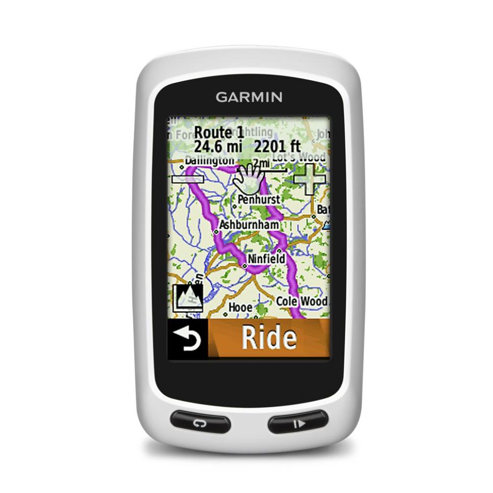
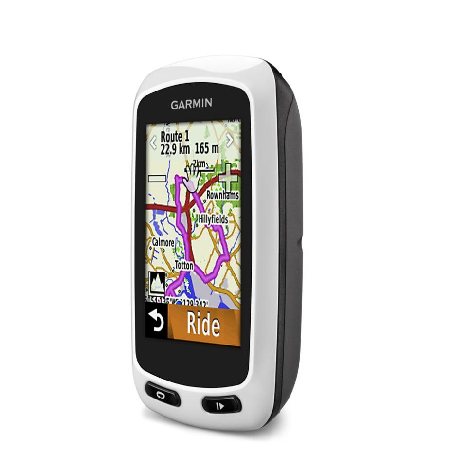
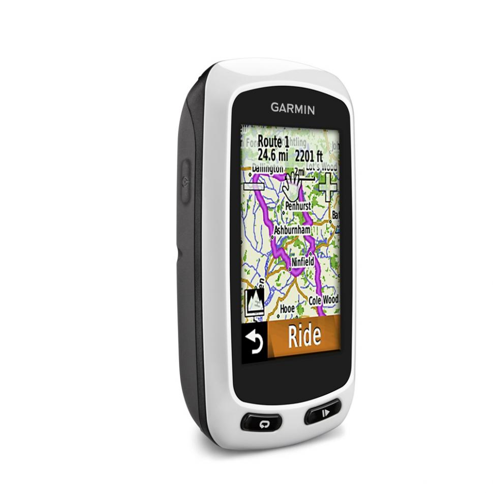
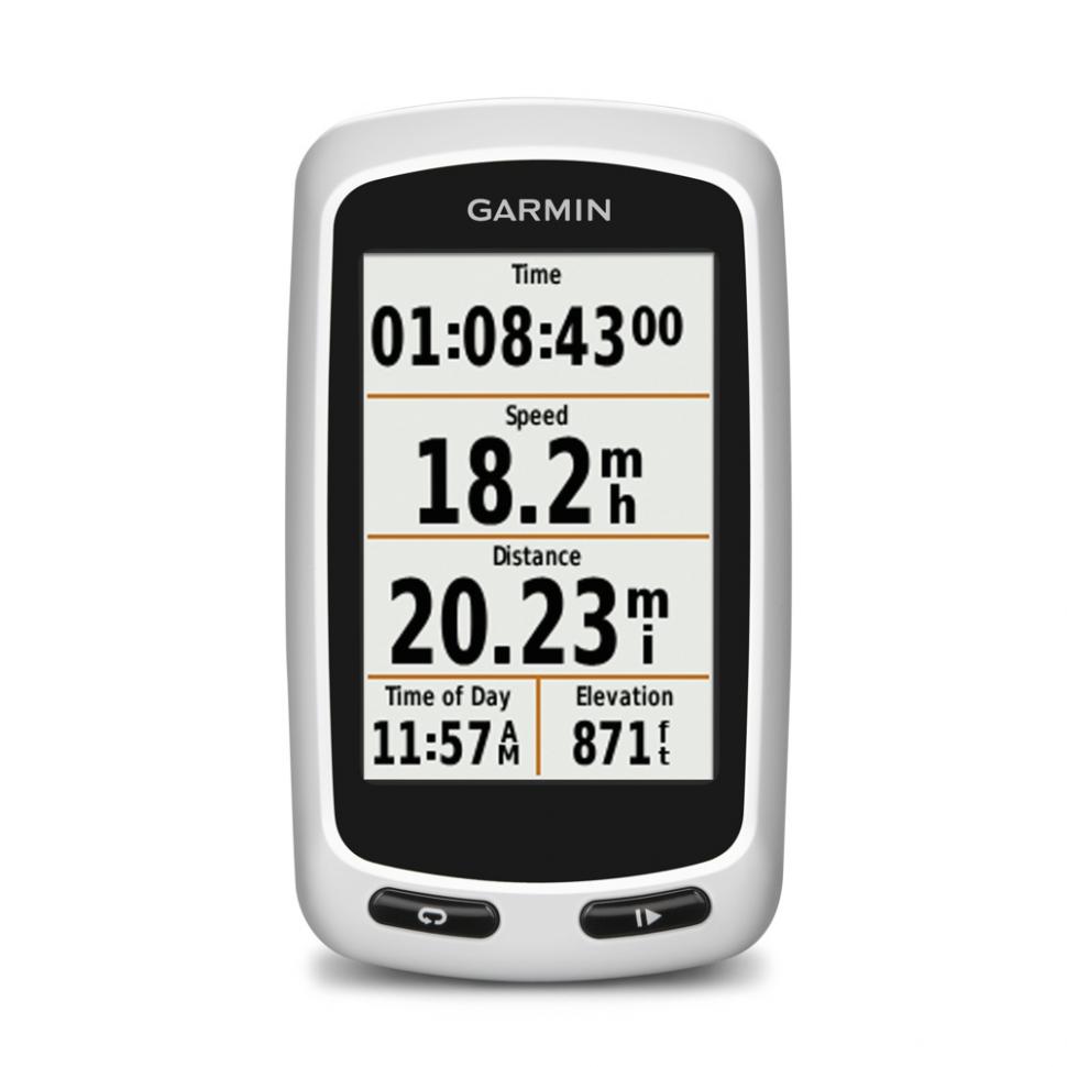
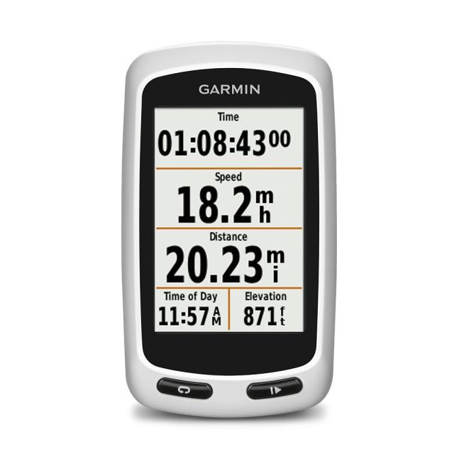
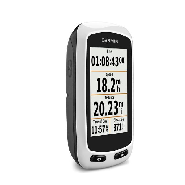
Garmin have launched two new GPS bike computers, the Edge Touring and the Edge Touring Plus, with navigation features and preloaded maps and points of interest.
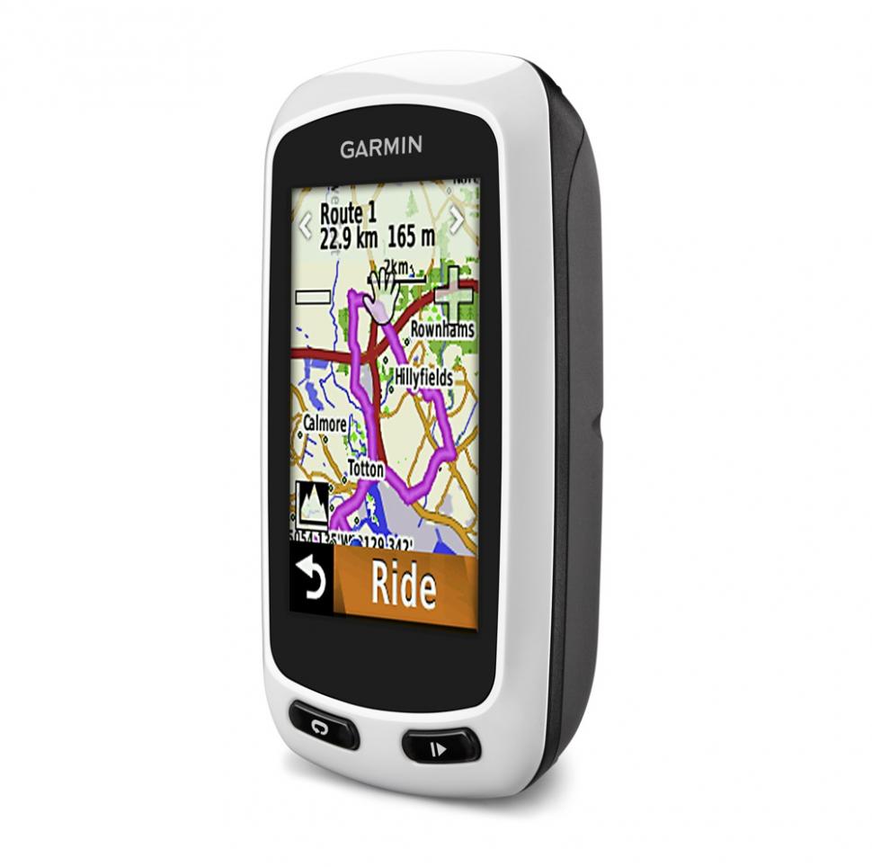
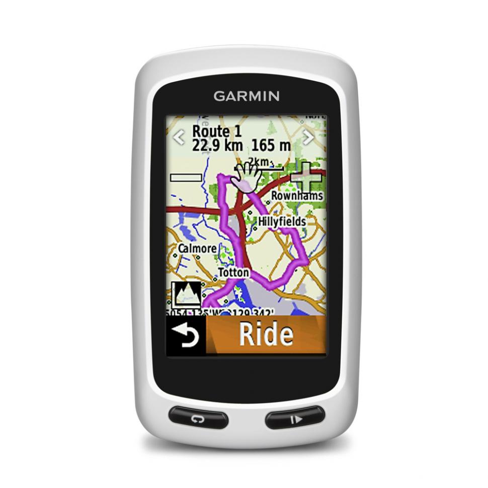
Both models offer road and off-road navigation, turn-by-turn directions and round-trip suggestions for rides of any chosen distance.
The Edge Touring is the cheaper of the two models with prices starting at £199.99. You can ask for directions to a given destination, as you would with a car GPS system, go for a round trip route, or follow a ride that you’ve downloaded from the internet. You can also create your own route manually.
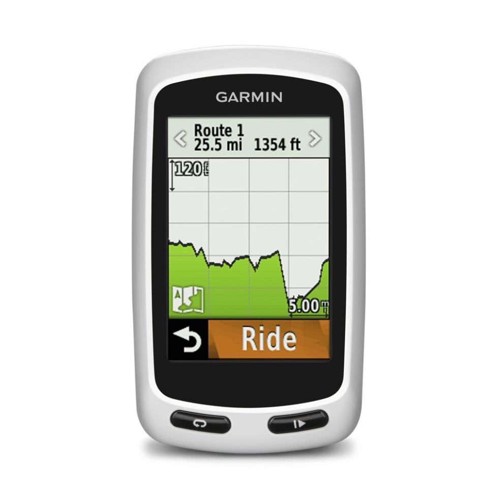
Garmin’s new Round Trip Routing is interesting. You tap in the distance you want to ride and the Edge Touring will suggest up to three different routes for you to choose from, including elevation profiles for each. You select the one you find most appealing and away you go.
You can choose between Cycling, Tour Cycling and Mountain Bike modes to get the route you’re after. Whatever option you go for, you’re given visual turn-by-turn instructions for following the route. Garmin’s Cycle Map for Europe comes preloaded on a simple ‘plug and play’ micro SD card.
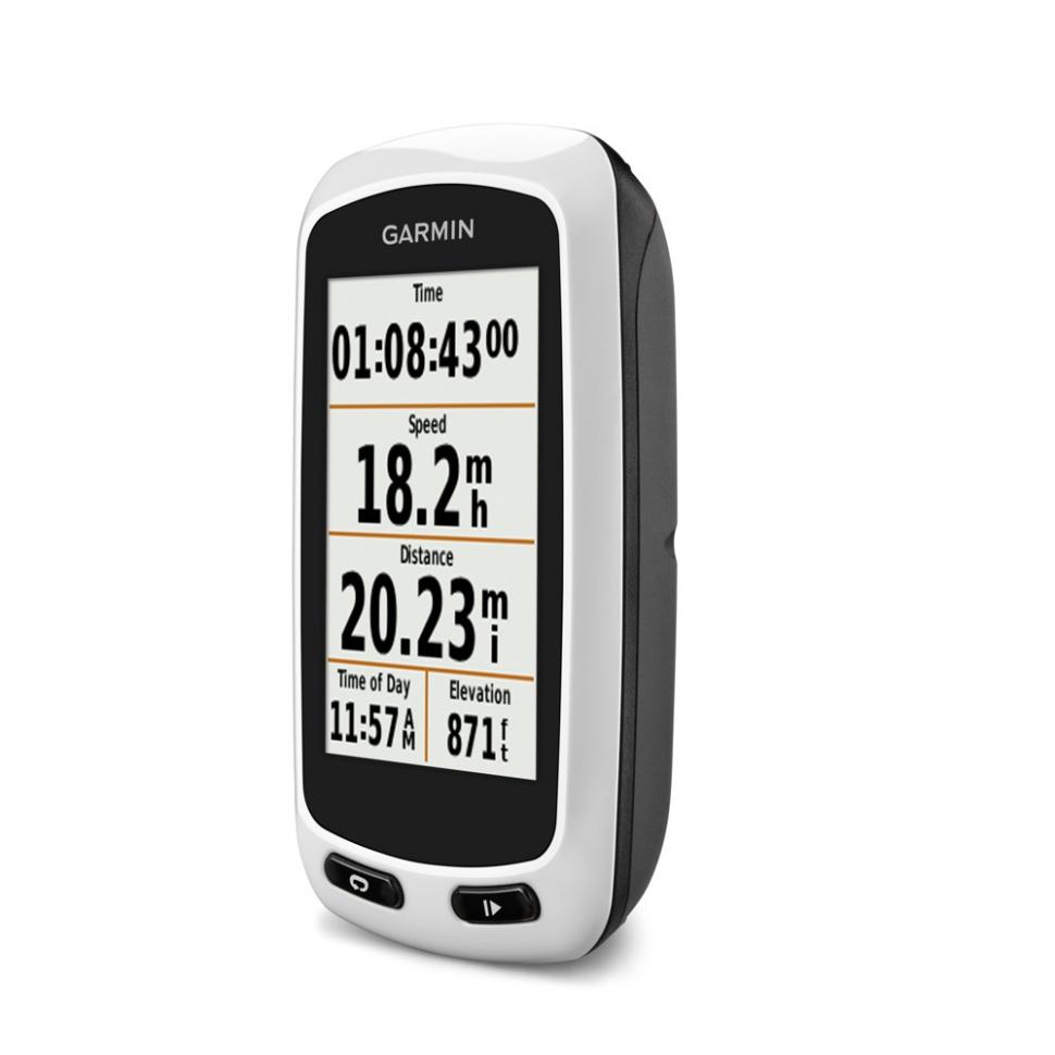
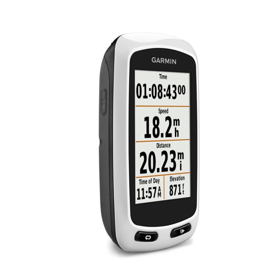
As well as the navigation features, the Edge Touring offers you key ride data such as time, speed, average speed, max speed and distance. You can view from one to 10 fields on a customisable screen.
The unit itself is water resistant, has a 2.6in (6.6cm) touchscreen (the same size as the existing Edge 810) that works in the wet and with gloves, and Garmin give a weight of less than 100g. They say that the battery will last up to 15 hours. If that’s not enough for you, it’s compatible with a Garmin powermonkey eXplorer external battery pack (£69.99) that will provide up to 20 hours more.
You can recharge a powermonkey eXplorer from the mains or via USB, or you can use its folding solar panel. Garmin say that the solar panel will recharge the power pack to 1/3 of its capacity in five hours.
The Edge Touring records all your ride details for you to download on to the Garmin Connect website. You can share your rides on Garmin Connect, search for new ones downloaded by other users, or look for Adventures on Garmin’s free Basecamp software. Find a ride you like and you can send it to the Edge Touring and ride it yourself.
.jpg)
The Edge Touring Plus (prices trom £249.99) is essentially the same computer as the Edge Touring but with the addition of ANT+ compatibility. That means you can pair it up wirelessly with a heart rate monitor, for example. This model also features a barometric altimeter for accurate elevation, gradient, ascent and descent data.
.jpg)
For more info go to Garmin's website.

Mat has been in cycling media since 1996, on titles including BikeRadar, Total Bike, Total Mountain Bike, What Mountain Bike and Mountain Biking UK, and he has been editor of 220 Triathlon and Cycling Plus. Mat has been road.cc technical editor for over a decade, testing bikes, fettling the latest kit, and trying out the most up-to-the-minute clothing. We send him off around the world to get all the news from launches and shows too. He has won his category in Ironman UK 70.3 and finished on the podium in both marathons he has run. Mat is a Cambridge graduate who did a post-grad in magazine journalism, and he is a winner of the Cycling Media Award for Specialist Online Writer. Now over 50, he's riding road and gravel bikes most days for fun and fitness rather than training for competitions.
Latest Comments
- ktache 4 hours 49 min ago
The small frame, the aggressive posture, lots of standover height.
- mctrials23 5 hours 45 min ago
As i've said before, the police should be sued for a lot of money when someone they have knowingly ignored has gone on to commit a serious crime....
- David9694 5 hours 53 min ago
'Bad parking' blocks firefighters multiple times on same emergency call-out...
- David9694 5 hours 56 min ago
Cambridgeshire boy, 13, crashes Audi into garden wall after taking it from home...
- Adam Sutton 6 hours 42 min ago
Good stuff. Now do it on cycleway C9 through Hammersmith to Chiswick.
- mark1a 6 hours 51 min ago
It's technically allowed but it's not known as "London's Orbital Car Park" for nothing.
- Dogless 7 hours 59 min ago
You're defending bombing hospitals and refugee camps and starving children.
- mattw 10 hours 39 min ago
Used car salesman is a complete attention-seeking plank....
- tubasti 10 hours 56 min ago
I don't know if they're any better, but they's certainly become more boring.
- FionaJJ 11 hours 23 min ago
At risk of being cynical, and stereotyping the police, it's so they don't have to leave the comfort of their panda cars and pursue on foot when...
Add new comment
14 comments
I'm just learning how to use my new Garmin Touring Plus. So far, it seems to be okay but I have found the screen difficult to read in the winter sun. Was advised by Garmin Help that turning the back light one makes it better but I'm not sure. One big question is how good the routes are that are offered when you ask it to route you from one town to another when you are touring. What criteria are considered - climbs, road size/traffic etc. Can Garmin be trusted to get it right? Has anyone experience of this because if the Garmin offers suitable touring routes it saves the trouble of designing your own unless you have something in particular you want to include. And comments or advice would be really appreciated.
Same here... "buy at your own peril" .. until Garmin sorts things out, this device is not a worthy navigation tool for your cycling trips ...
I have the Edge Touring. I couldn't agree more with the " buy at your peril" as indicated above. Not user friendly and extremely difficult to preplan routes and download to the device which is why I bought it in the first place.More trouble than its worth.I couldn't get support to answer the phone which irritated me even more.
I bought a Garmin Touring Plus, and was very excited at this low cost unit with preloaded maps!! it soon turned into frustration, when using the round route tripping it tried to send me down every alley, dirt track and un-paved road possible despite setting the unit to avoid these, the round route tripping, although found 3 routes around 30-40 miles ok if you asked for 80,90,100+ miles it was just searching for over 15 minutes without finding a single route, to abandoning the ride and returning home, and data corrupted and failed to upload!! In Short, buy at your peril-not impressed unit returned and refund issued. spent a lot of time on phone to support as well who talked me through a couple of hard resets to no avail, and told it should only take 2-3 mins to find 3 routes regardless of distance!!
Garmin has so much potential and builds so many almost-usable devices, then usually ruins them by trying to make them do everything at once. What they need is unit configuration, that would allow a "sport" GPS to be configured by the user for use in various sports.
Most of the stuff on my 800 is superfluous to me - I'm not racing anyone. I would be happy if it just had more usable mapping and routing and - ideally - at least 12 hour battery life.
Why should cycle touring require a completely different unit from... um.. what was the point of the 800/810 again?
Buy a used 705 on ebay as backup, then you can charge one while using the other one. Charging while using is very unreliable and there is always risk of the port getting wet.
Perhaps they should sort out the navigation, altitude and firmware on the 810 first?
So the reliability of the 810 hasn't really improved much over the 705?
Today I 'enjoyed' a ride at -25m with a gradient of -3% - even though the altitude was 100m+ and grade of 8%, as it was 8 hours later.
If it did Geocaching too, then I'd be sold.
I will just buy a new 800 (complete performance kit) for an additional £60 and save me all the palavas of this new unit.
GPS gives you altitude - if it tracks enough satellites at once. I really like the look of these.
It does also include a 'barometric altimeter for accurate elevation, gradient, ascent and descent data'. Does this mean the base model doesn't give you gradient? That would be a shame. I still feel the Bryton Rider 60 offers a lot more, inc bluetooth, except that Bryton seem reluctant to actually sell them. Announced in May, they've yet to arrive in the UK.
On enquiry, Bryton say the Rider 60 should go on sale this month, September.
As for "accurate elevation, gradient, ascent and descent data" it wouldn't have to improve much over my current Edge 705, which told me I was -57m last weekend - actual elevation for location is +105m.
Loving the garmin con. How much does it cost to enable Ant+ - certainly not £50.
i'll be sticking with a 500 and using my imagination to work out where to ride rather than be sent up an A road on a computer generated route.